
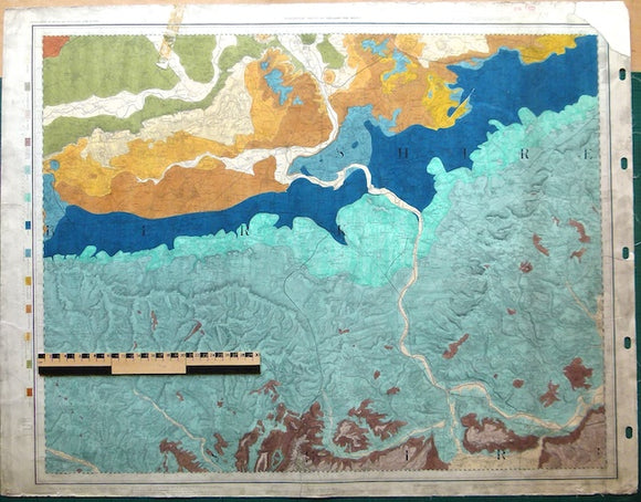
Sheet 13, Old Series 1". 1891, topography 1830.
Sheet 13, Old Series 1". 1891, topography 1830. Flat, 66 x 85cm, linen-backed, right margin punched for hanging. Minor marginal tears, before backing with loss of NE corner into border. Old cellotape stain into top edge of map. Blues dark but base map is legible. In fair condition
About the England & Wales One Inch Old Series
The Geological Survey of England and Wales used the Old Series of the Ordnance Survey topographic map at a scale of one inch to the mile as its basemap, initially. These engraved basemaps were published and revised between 1805 and 1885; the sheet sizes varied and the layout and numbering system were eccentric. The Old Series geological maps were hand-coloured and without geological sections, which were published separately. The GS of E&W published the Old Series from 1850 to 1900, when it switched to the colour printing and the New Series one inch maps. However, old stock of the Old Series continued to be issued, hand-coloured, until the 1930s.
See also: Index Map for England & Wales One Inch Old Series.