
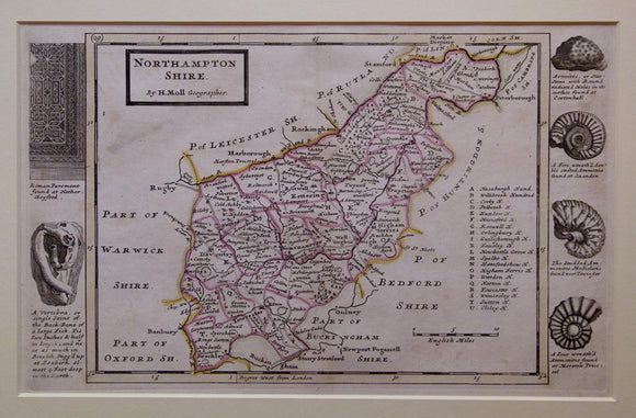
Northamptonshire, 1724
Northamptonshire, 1724, from A Set of Fifty New and Correct Maps of England and Wales pub. by Herman Moll. 1724. Scale, approx. 1”=5miles (1:316,800). 20 x 31,5cm (8”x 12.5”)hand-coloured outlining of engraved NON-geological map. Included because of Moll’s use of fossils to decorate the map in place of the typical antiquities or family crests. In archival mount board frame, 35 x 46cm (13.75 x 18”). Clear plate mark, trace of old centrefold, clean, bright, in very good condition. Eng non-survey Moll.