
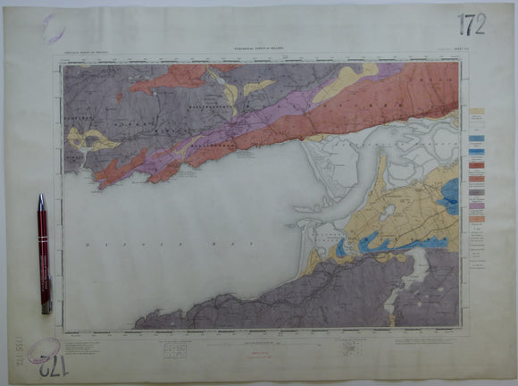


Ireland sheet 172, Dingle Bay, 1” scale. 1879. 30% Bay. Base map not dated. Coloured 1910. Hand-coloured
Ireland sheet 172, Dingle Bay, 1” scale. 1879. 30% Bay. Base map not dated. Coloured 1910. Hand-coloured engraving, flat, trimmed 43 x 58cm. Bright colours, clean. Library stamps in upper and lower left corners and stencilled numbers in upper right and lower left corners. In very good condition.
See also: Index Map for Irish One Inch Survey.