
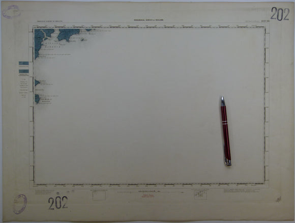


Ireland sheet 202, Old Head of Kinsale, 1” scale. 1857. First edition. Base map not dated. 95% sea. Hand-coloured
Ireland sheet 202, Old Head of Kinsale, 1” scale. 1857. First edition. Base map not dated. 95% sea. Hand-coloured engraving, flat, trimmed 43 x 57.5cm, clear plate mark. Bright colours, clean, slightly age-toned. Library stamps in upper and lower left corners and stencilled numbers in upper right and lower left corners. In very good condition
See also: Index Map for Irish One Inch Survey.