
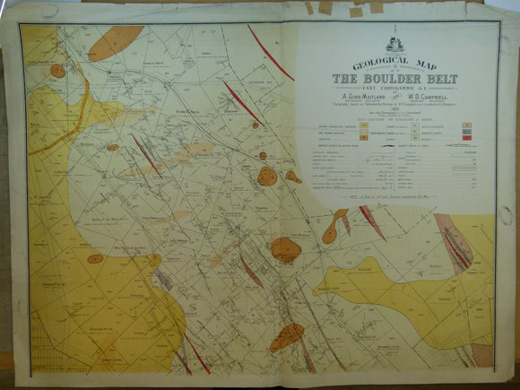


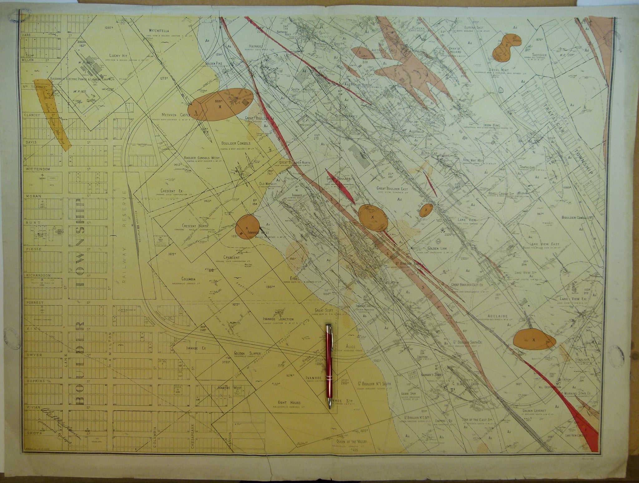

Western Australia, Geological Map of Boulder Belt, East Coolgardie G.F., 1903. By Gov’t geologists, A.Gibb Maitland & W.D. Campbell
Western Australia, Geological Map of Boulder Belt, East Coolgardie G.F., 1903. By Gov’t geologists, A.Gibb Maitland & W.D. Campbell. Colour printed map at scale 1:3,168 (1” =4 chains = .05 mile), in two parts, each 77 x 102cm. Coolgardie is located approx. 500km east of Perth. Age-toned, minor marginal tears, clean old tape repairs, both sheets folded into halves, small library stamps in all corners. Colours bright, slightly dusty. In good condition.