
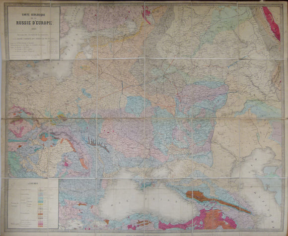


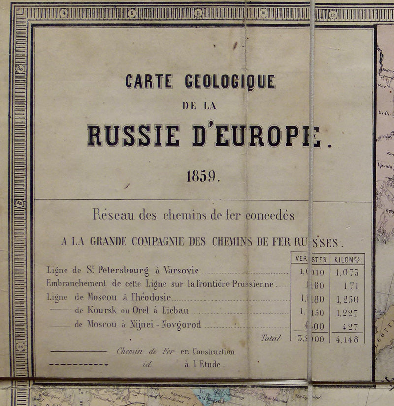

Carte Geologique de la Russie d’Europe, 1859. Approx 1:3,675,000 scale. (77 x 93.5cm) hand-coloured engraved map
Carte Geologique de la Russie d’Europe, 1859. Approx 1:3,675,000 scale. (77 x 93.5cm) hand-coloured engraved map by E. Andriveau-Goujon, Paris. Originally folded, then dissected and mounted on linen to fold. Flattened old folds and neatly repaired tears visible. Paper age-toned but colours clear and bright. M/s blue and orange lines appear to be projected railway lines. Extents include Berlin to Urals, south Finland to entire Black Sea. folds into contemporary card sleeve 20.4 x 17cm covered in marbled paper, with m/s title and early owner’s signature. Map in good condition. Sleeve in fair condition. Together with accompanying report Explorations Mineralogique dans la Russie d’Europe: Resume de Observations Recueilles en 1857 & 1858, by Jules Guillemin. 1859, first edition. Paperback, cover very worn with chipped edges, slight foxing to first and last pair of pages, rest are clean, most are uncut. Apart from cover, in good condition. Rare. Jules Guillemin was a civil and mining engineer attached to the Grande Societe des Chemins de Fer Russes. The primary focus of the report was to explore the coal and salt resources for industrial development. Guillemin acknowledged the work of Murchison in 1841.