


Knox, Robert, (1855). East Yorkshire, between the Rivers Humber and Tees; with a Trigonometrically Surveyed Map
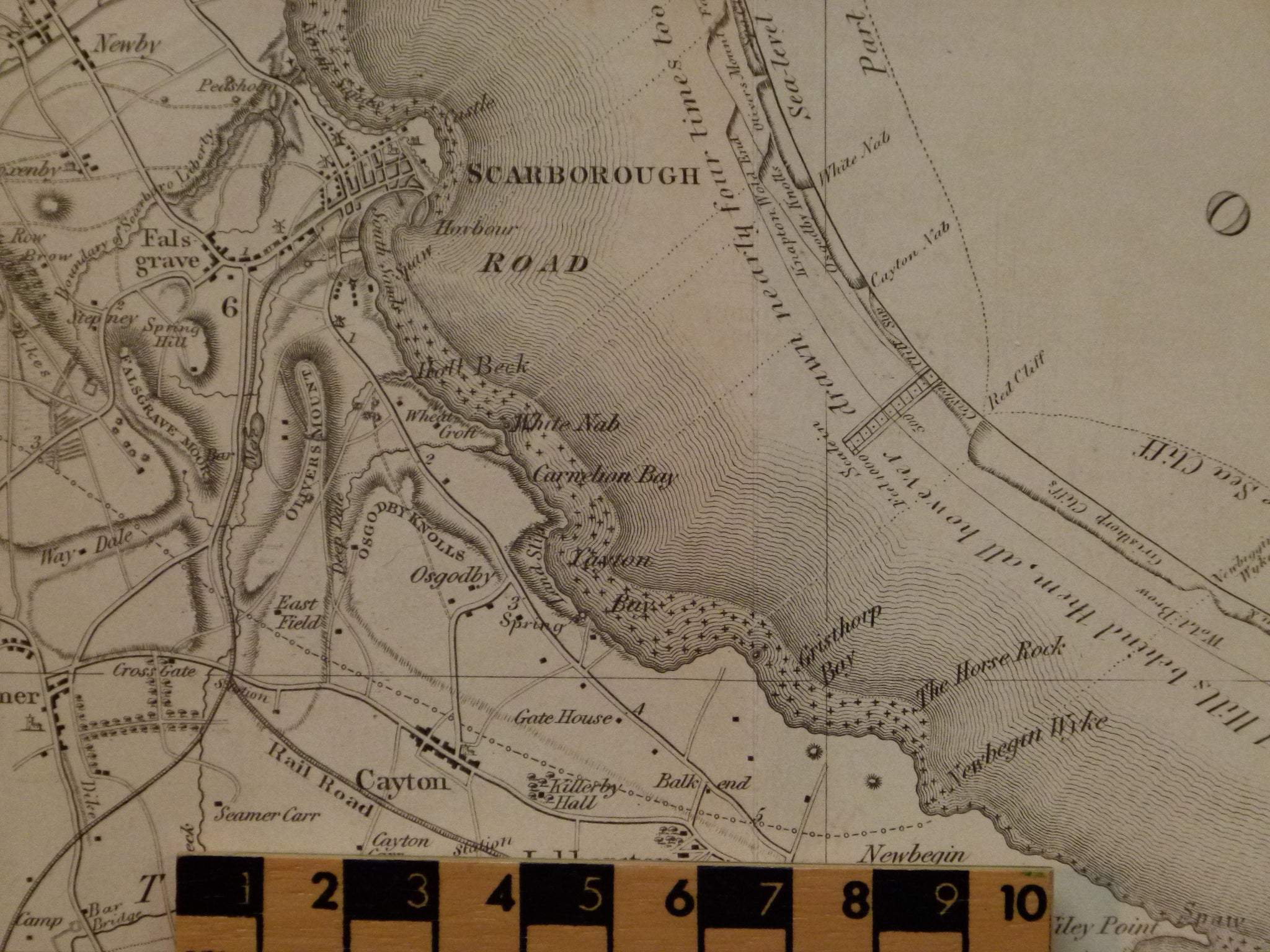
Knox, Robert, (1855). Descriptions Geological, Topographical and Antiquarian in East Yorkshire, between the Rivers Humber and Tees; with a Trigonometrically Surveyed Map, extending Twenty-five Miles from Scarborough; accompanied by a Map of all Yorkshire, two of England and Eighteen More Descriptive Plates of Diagrams, etc, all in Illustration of the Above Subjects, with occasional Remarks, Growing out of these Topics. Printed for the author. The title is a precursor to a garrulous and discursive text; however, it has Knox’s one inch scale engraved map of the Scarborough area, A Map of the Country ‘round Scarborough in the North & East Ridings of Yorkshire, from actual Trigonometrical Surveys with Topographical, Geological and Antiquarian Descriptions by Robert Knox of Scarborough. Originally published in 1821 republished with additions in 1849. Scale 1:63,360 (1in=1mi) 65 x 60cm (25.5 x 23.5in). In this edition, Knox has added an informative geological coastal section to the map. Worn and bumped. Top of both hinges is torn with front hinge loose. Text is age-toned. Withdrawn stamp on front end paper and library blind stamp to title page. In fair condition, rare.