Free UK postage
Allan, Douglas A. (1926). ‘the Volcanic History of Southern Fife’ offprint. Durham Phil Soc.
Allison, I. et al (eds), 1985. An Excursion Guide to the Moine Geology of the Scottish Highlands. Scottish Academic Press, 270 pp. 1st edition. Scottish Academic Press.
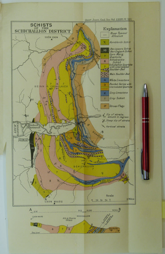
Anderson, EM, (1923), ‘Schists of the Schichallion District’. Fold-out colour printed geological map and section, 1:63,360. QJGS.
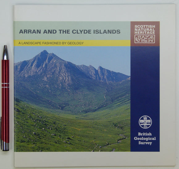
Anon. 1997. Arran and the Clyde Islands; a Landscape Fashioned by Geology. British Geological Survey. British Geological Survey.
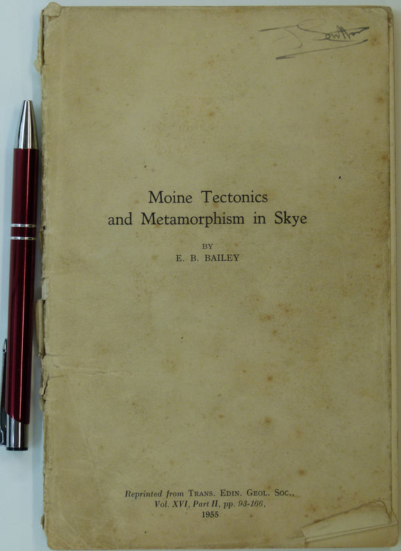
Bailey, E.B. (1955). ‘Moine Tectonics and Metamorphism in Skye’, in reprint from Trans. Edinburgh Geological Society. Edinburgh Geological Society.
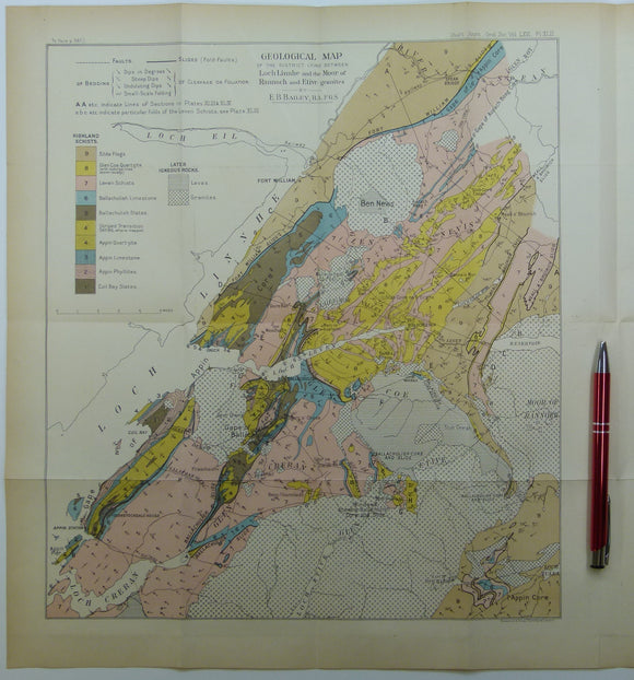
Bailey, Edward B, (1910), ‘Geological Map of the District Lying Between Loch Linnhe and the Moor of Rannoch and Etive Granites. QJGS.
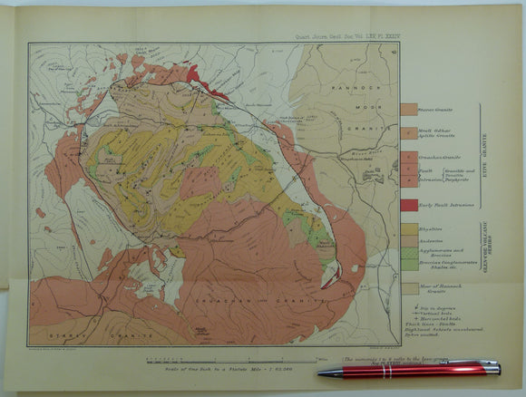
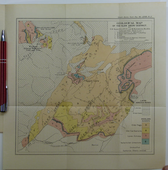
Bailey, Edward B, (1912), ‘Geological Map of the Glen Orchy District. Fold-out colour printed geological map. QJGS.
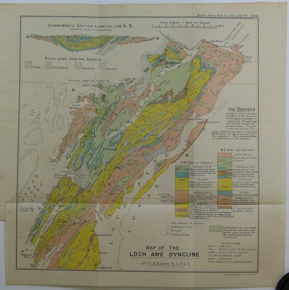
Bailey, Edward B, (1913), ‘Map of the Loch Awe Syncline’. Fold-out colour printed geological map and section. QJGS.
Bailey, Patrick (2004) Orkney. Newton Abbot, Pevensey Island Guides/ David & Charles. David & Charles.
Bryce, James (1872). The Geology of Arran and the other Clyde Islands. Glasgow: William Collins, 354pp. 4th edition. William Collins.
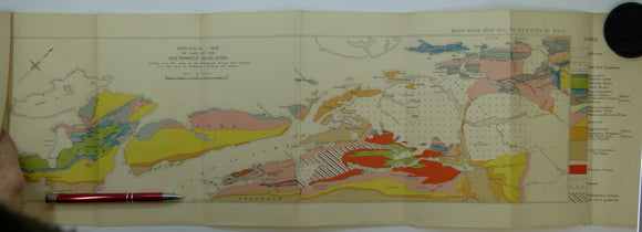
Bryce, James. (1873). ‘[Geological] Map of the Islands of Skye and Raasay’, colour printed map with sections,. Geological Society of London.
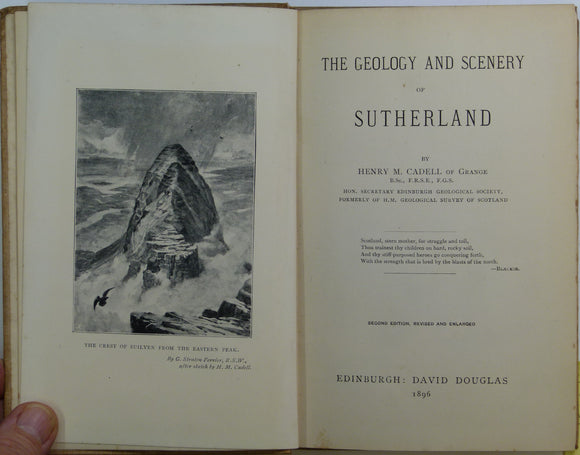
Cadell, HM (1896). The Geology and Scenery of Sutherland. Edinburgh: David Douglas, 104pp + 4 page index. 2nd edition. David Douglas.
Clough, CT., Maufe, HB., and Bailey, Edward B, (1909), geological map (untitled) Glens Coe and Etive and mountains between. Fold-out colour printed. QJGS.
Darling, f. Fraser (1947). Natural History in the Highlands and Islands. Collins: London. New Naturalist Series.
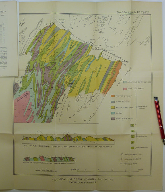
Elles, Gertrude L., (1934). ‘Geological Map of the Northern End of the Tayvallich Peninsula’ fold-out colour printed map 1:10,560. QJGS.
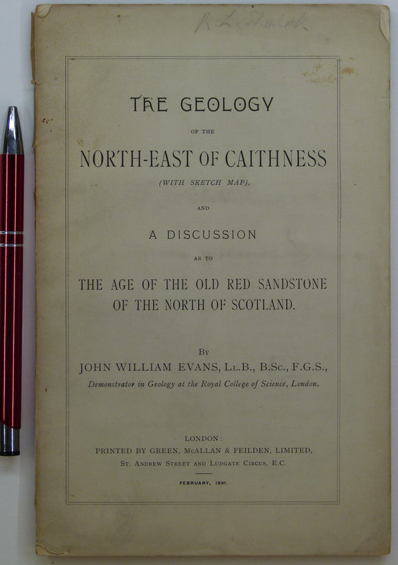
Evans, John W., (1891), geological map (untitled) of North-East Caithness. Fold-out b/w printed geological map. private publication.
Faujas St.-Fond, B. (1907). A Journey through England and Scotland to the Hebrides in 1794, 1907. Hugh Hopkins.
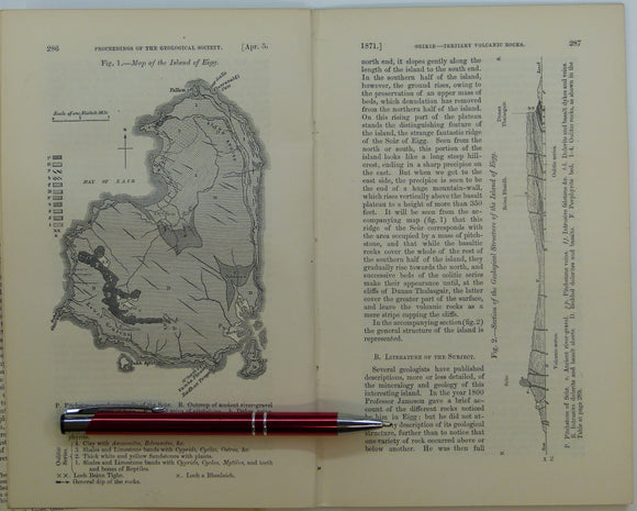
Giekie, Archibald, (1871), ‘Map of the Island of Eigg. b/w geological map, 1:63,360,. QJGS.
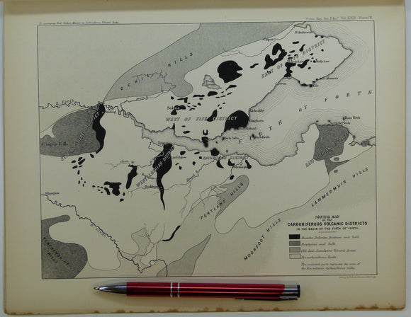
Giekie, Archibald, (1879), ‘On the Carboniferous Volcanic Rocks of the Basin of the Firth of Forth: their Structure in the Field. Royal Society of Edinburgh.
Goodenough, K, et al (2007). Exploring the landscape of Assynt. British Geological Survey, 56pp. Reprint of 2004 1st edition. British Geological Survey.
Green, John FN., (1931), ‘Geological Map of part of the Southwest Highlands’. Fold-out colour printed geological map,. QJGS.
Gribble, CD (ed), 1976. Ardnamurchan; a Guide to Geological Excursions. Edinburgh Geological Society, 122 pp. 1st edn. Edinburgh Geological Society.
Haswell-Smith, Hamish (1996). The Scottish Islands; a Comprehnsive Guide to Every Scottish Island. Edinburgh, Canongate. 423 pp. 1st edition. Canongate.
Jamieson, Thomas F., (1863). ‘Sketch-Map of a part of of Lochaber’. Fold-out colour printed map, 1:253,440. QJGS.


![Bryce, James. (1873). ‘[Geological] Map of the Islands of Skye and Raasay’, colour printed map with sections,](http://geolmaps.com/cdn/shop/products/BryceSkye_Raasay1873_1_{width}x.jpg?v=1619628970)
![Bryce, James. (1873). ‘[Geological] Map of the Islands of Skye and Raasay’, colour printed map with sections,](http://geolmaps.com/cdn/shop/products/BryceSkye_Raasay1873_1_580x.jpg?v=1619628970)