Free UK postage
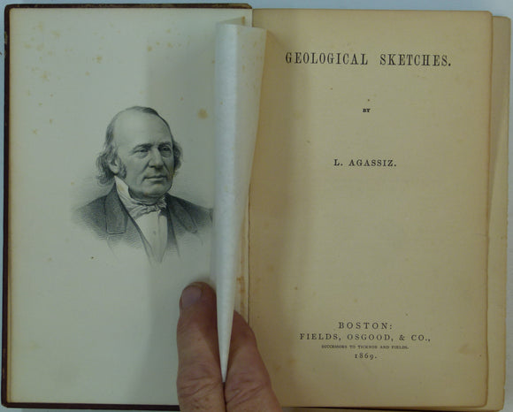
Agassiz, Louis (1869). Geological Sketches. Boston: Fields, Osgood & Co. 1st edition, 311pp. Hardback,. Fields Osgood.
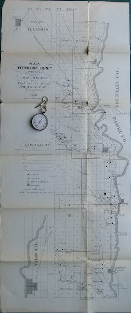
Annual Report of State Geologist of Indiana, 1869. 1869.
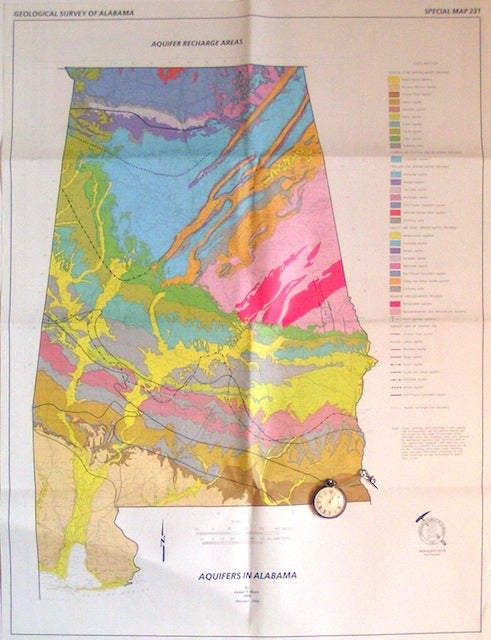
Aquifers in Alabama; Aquifer Recharge Areas, 1998. Alabama.
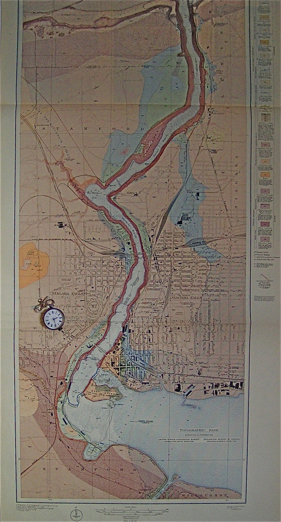
Geologic Atlas of the US: Niagara Folio, New York, 1913. USGS New York.
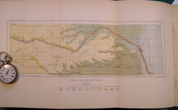
Geologic Map of Southwest Kansas in "A geological Reconnaisance in Southwestern Kansas" by Robert Hay in Bulletin No.57 of the USGS, 1890. USGS Kansas.
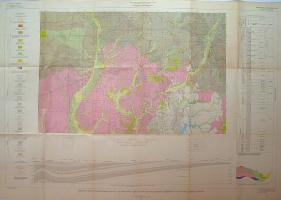
Geologic Map of the Indianapolis 1°x2° Quadrangle, Indiana and Illinois, Showing Bedrock and Unconsolidated Deposits, 1961. Indiana.
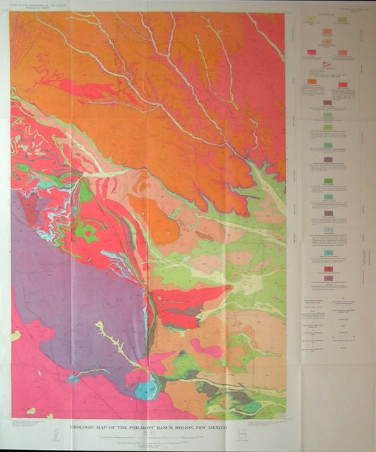
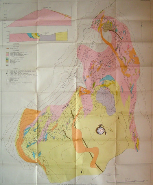
Geologic Map of the Philmont Ranch Region, 1964. New Mexico.
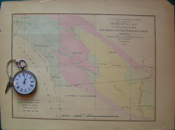
Geological Map of the country between San Diego and the Colorado River. California.
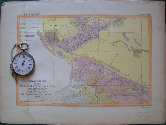
Geological Map of the Tejon Pas and Ca?ada de las Uvas and Vicinity. California.
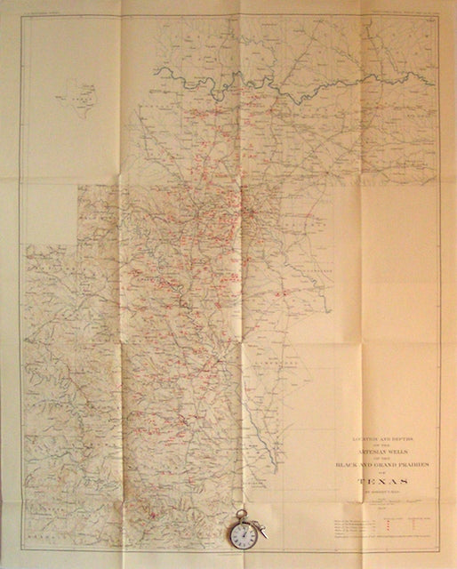
Location and Depth of the Artesian Wells of the Black and Grand Prairies of Texas, 1898. USGS Texas.
Maclure, William (1817). Observations on the Geology of the United States of America; A 1962 REPRODUCTION. Werner Fritsch.
Map and Sections of the Quad Creek Area, Montana. Geol.Soc. Am Montana.
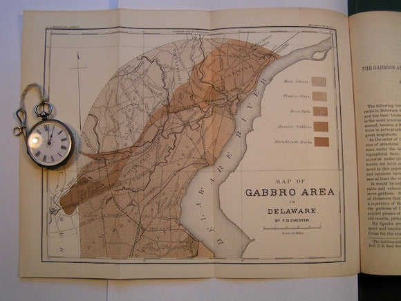
Map of Gabbros Area in Delaware in "The Gabbros and Associated Rocks in Delaware" by FD Chester in Bulletin No. 59 of the USGS, 1890. Scale 1"=3miles. Colour print, 9"x11.5". USGS Delaware.
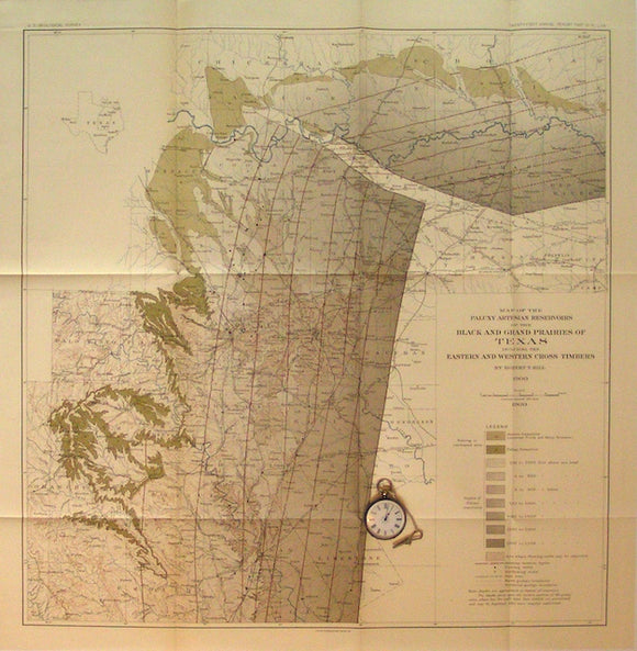
Map of the Paluxy (formation) Artesian Reservoirs of the Black and Grand Prairies of Texas, 1900. USGS Texas.
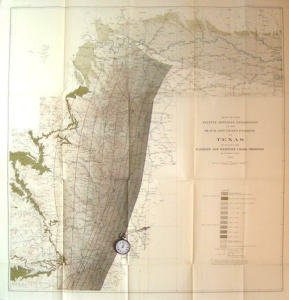
Map of the Trinity (formation) Artesian Reservoirs of the Black and Grand Prairies of Texas, 1900. USGS Texas.
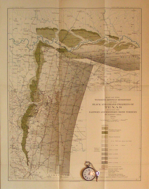
Map of the Woodbine (formation) Artesian Reservoirs of the Black and Grand Prairies of Texas, 1900. USGS Texas.
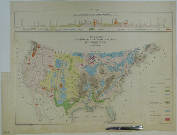
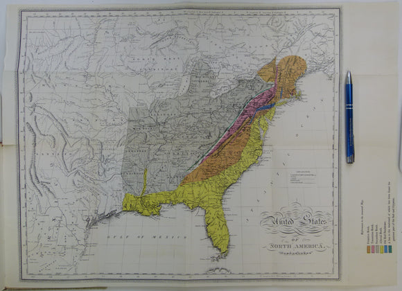
Marcoux, Jules (1855). ‘Carte Geologique des Etats-Unis et des Provinces Anglaises’ from Annales des Mines, 5th Series, Vol 7, page 320. Hand-coloured. Annales des Mines.
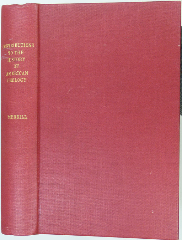
Merrill, George P (1906). Contributions to the History of American Geology. Washington: Gov’t Printing Office, pp 189 to 734 + 37 plates. Hardback,. Smithsonian.
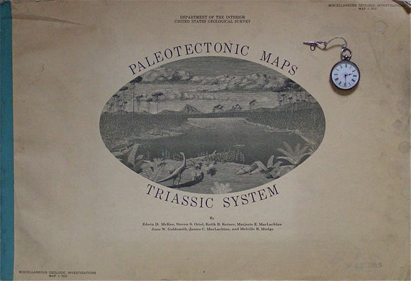
Paleotectonic Maps – Triassic System, Miscellaneous Geologic Investigations I-300, 1959. USGS, McKee, ED et al.
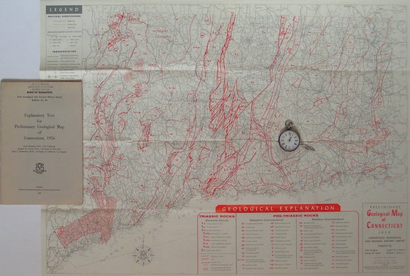
Preliminary Geological Map of Connecticut, 1956. Connecticut.