
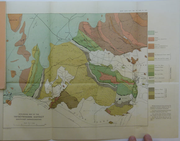


Fearnsides, W.G. (1910). Geological Map of the Ynyscyhaiarn District, South-East Carnarvonshire’, fold out colour printed map
Fearnsides, W.G. (1910). Geological Map of the Ynyscyhaiarn District, South-East Carnarvonshire’, fold out colour printed map 1:21,120 scale (3”=1 mile), 34 x 55cm, from ‘The Tremadoc slates of South-East Carnarvonshire [N. Wales]’ offprint from the Quarterly Journal of the Geological Society. v.66, pp.142-188. Includes two fold out b/w sections at 1:10,560 vertical and horizontal scale. In orange paper cover, with signature of previous owner. Map and text age-toned, clean. In very good condition.