Free UK postage
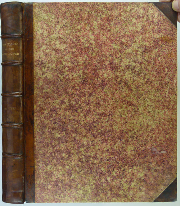
Mantell, Gideon (1822). The Fossils of the South Downs; or Illustrations of the Geology of Sussex. London: Lupton Relfe, 227 +xvi pp +42 plates. Hardback,. Lupton Relfe.
Mantell, Gideon (1822). The Fossils of the South Downs; or Illustrations of the Geology of Sussex. London: Lupton Relfe, 227 +xvi pp +42 plates. Hardback, quarto, half leather bound, patterned...
Regular price £1,65000 £1,650.00
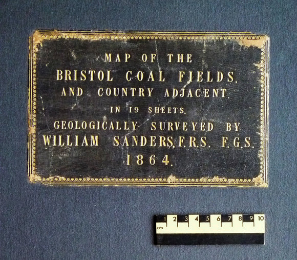
Sanders, William (1864). Map of the Bristol Coal Field and Country Adjacent in 19 Sheets, Geologically Surveyed. Hardback atlas, Rare. self published.
Sanders, William (1864). Map of the Bristol Coal Field and Country Adjacent in 19 Sheets, Geologically Surveyed. Hardback atlas, rebound with modern blue cloth covered boards, retaining original leather label....
Regular price £1,20000 £1,200.00
Mantell, Gideon. (1833). The Geology of the South-East of England. London: Longman et al, 1st edition,. Longman et al.
Mantell, Gideon. (1833). The Geology of the South-East of England. London: Longman et al, 1st edition, xix + 416 pp + 5 lithographic fossil plates of which 1 folds out,...
Regular price £85000 £850.00
Lyell, Charles. (1835). Principles of Geology. London: John Murray, 4th edition, 4 volumes:. John Murray.
Lyell, Charles. (1835). Principles of Geology; Being an Inquiry How Far the Former Changes of the Earth’s Surface are Referable to Causes Now in Operation. London: John Murray, 4th edition, ...
Regular price £75000 £750.00
Carte Géologique de la France. (1889) Ministère des Travaux Publics, 1st edition. Paris: Baudry et Cie. 1:1,000.000 scale. Colour printed,. Ministere des Travaux Publique.
Carte Géologique de la France. (1889) Ministère des Travaux Publics, 1st edition. Paris: Baudry et Cie. 1:1,000.000 scale. Colour printed, 108.5 x 118.5cm, dissected, mounted on linen and folded to...
Regular price £40000 £400.00
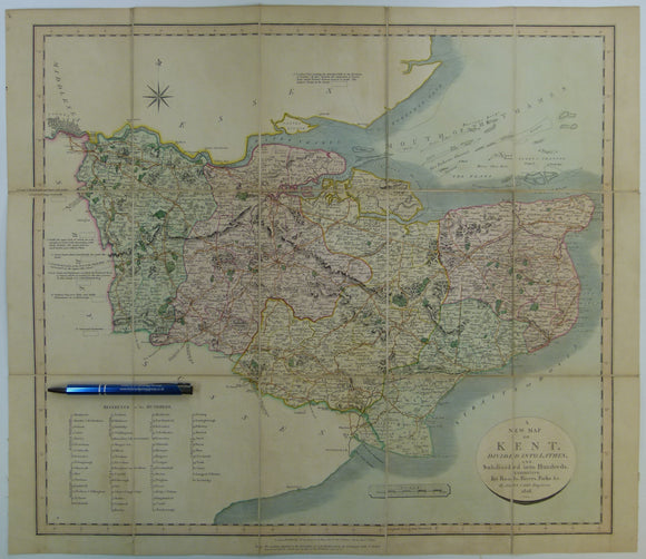
Cary, John. (1828). A New Map of Kent. London: John Cary. With William Smith's geology engraved but coloured over.Hand coloured engraved map 51.5 x 59.5cm. John Cary.
Cary, John. (1828). A New Map of Kent. London: John Cary. Hand coloured engraved map 51.5 x 59.5cm dissected, mounted on linen and folded to 17.5 x 12cm between marbled...
Regular price £19500 £195.00
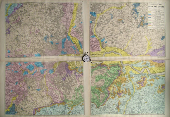
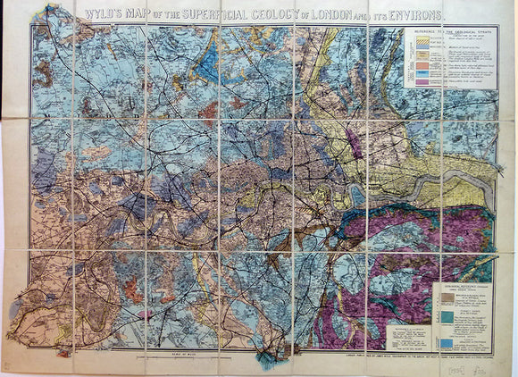
Wyld’s Map of the Superficial Geology of London and its Environs. Wyld, James, jr..
Wyld’s Map of the Superficial Geology of London and its Environs, c.1880. Hand-coloured, 58 x 70.5cm (16.5 x 26.25 in), scale 1:63,360 (1in = 1 mile). Cut, mounted on linen...
London. (1880). Wyld’s Map of the Superficial Geology of London and Environs. London: James Wyld. Colour lithograph 1:63,360. Wyld, James, jr..
London. (1880). Wyld’s Map of the Superficial Geology of London and Environs. London: James Wyld. Colour lithograph 1:63,360 (53 x 70cm folding to 19 x 11cm). dissected, mounted on linen...
Regular price £16500 £165.00
Map of the English Lakes and adjoining Country, Geologically Coloured, 1855. Ruthven, John.
Map of the English Lakes and adjoining Country, Geologically Coloured, 1855 (d.o.m.), (usually missing) by John Ruthven (1790-1868). Lithological legend. Hand coloured engraving, 47.5 x 43cm (18.75 x 17in.) Folded....
Regular price £15000 £150.00
Sheet 30 Old Series 1866. Cornwall, north coast: Tintagel to Holywell Bay, inland: Bodmin, Lostwithiel. Topography 1813, geology 1866,. British Geological Survey.
Sheet 30 Old Series 1866. Cornwall, north coast: Tintagel to Holywell Bay, inland: Bodmin, Lostwithiel. Topography 1813, geology 1866, issued 1887. Hand-coloured engraving, 66 x 99cm, Dissected, mounted on linen and folded...
Regular price £13000 £130.00
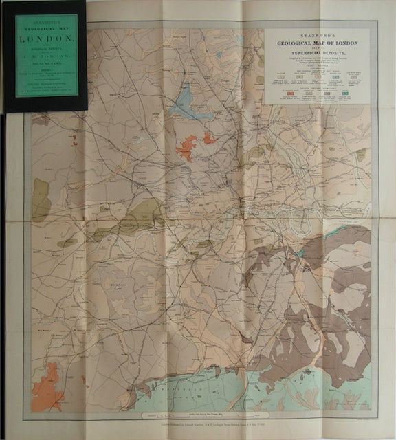
London. Jordan, J. B. and Whitaker, W. (1894). Stanford’s Geological Map of London: Shewing Superficial Deposits. London: Edward Stanford. 3rd ed. Stanford.
London. Jordan, J. B. and Whitaker, W. (1894). Stanford’s Geological Map of London: Shewing Superficial Deposits. London: Edward Stanford. 3rd edition. Colour printed, dissected, mounted on linen and folded into...
Regular price £12500 £125.00
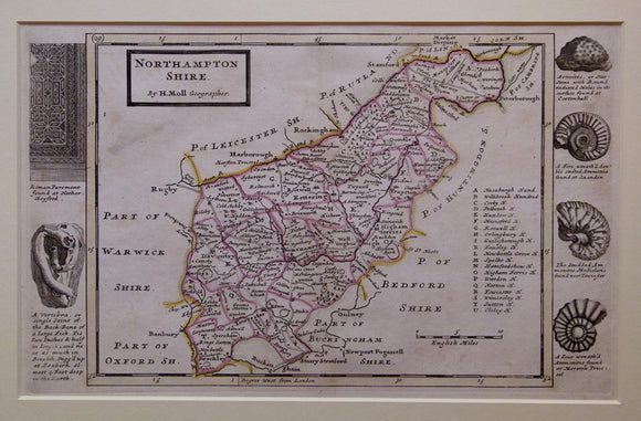
Northamptonshire, 1724. Herman Moll.
Northamptonshire, 1724, from A Set of Fifty New and Correct Maps of England and Wales pub. by Herman Moll. 1724. Scale, approx. 1”=5miles (1:316,800). 20 x 31,5cm (8”x 12.5”)hand-coloured outlining...
Regular price £11500 £115.00
Sheet 43, Old Series1”.(1845) topography 1831, geology 1845, issued 1859. Hand-coloured engraving, 66 x 80.5cm,. British Geological Survey.
Sheet 43, Old Series1”.(1845) topography 1831, geology 1845, issued 1859. Hand-coloured engraving, 66 x 80.5cm, four quarter sheets, joined, dissected and mounted on linen folding to 22 x 13.5cm between...
Regular price £10400 £104.00
London and environs, 1894. Stanford.
London and environs, 1894. Scale 1"=1mile (1:63,360). Colour print, 27"x24". In good to very good condition. Cut, mounted on linen and folded in book-style hard covers.
Regular price £9900 £99.00
Farey, John (c1814). ‘A [Geological] Map of Derbyshire and parts of the seven adjacent counties shewing the principal Strata. MacMillan.
Farey, John (c1814). ‘A [Geological] Map of Derbyshire and parts of the seven adjacent counties shewing the principal Strata and Soils', and ‘A Section of the three lowest assemblages of Strata...
Regular price £9500 £95.00
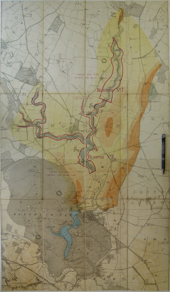
Geological Map of Blenheim area, Oxfordshire. Manuscript
Geological Map of Blenheim area, Oxfordshire. Manuscript hand-coloured on OS county 6 inch to the mile base map assembled from four sheets 1884, 99 x 57cm. Dissected and mounted on...
Sheet 41, Old Series1”.(1845) topography 1831, geology 1845, Hand-coloured engraving, 68 x 98cm, dissected and mounted. British Geological Survey.
Sheet 41, Old Series1”.(1845) topography 1831, geology 1845, Hand-coloured engraving, 68 x 98cm, dissected and mounted on linen folding to 22 x 12.5cm between marbled soft card covers with label...
Regular price £8400 £84.00
Geological Map of London and Environs, showing the Superficial Deposits,1890. Bacon.
Geological Map of London and Environs, showing the Superficial Deposits,1890s, Scale 1"=1mile. Colour print set of 4 sheets, each 13.5"x21", not joined. In very good condition. Flat sheets have original...
Hull, Edward. (1872). A Treatise on the Building and Ornamental Stones of Great Britain. London: Macmillan, 1st edition,. MacMillan.
Hull, Edward. (1872). A Treatise on the Building and Ornamental Stones of Great Britain and Foreign Countries, Arranged according to their Geological Distribution and Mineral Character. London: Macmillan, 1st edition,...
Regular price £7500 £75.00
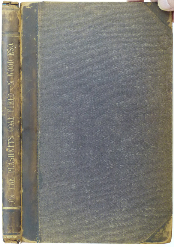
Wood, Nicholas. (1862). ‘On the Upper and Lower Beds of Coal of the Counties of Northumberland and Durham’. Hardback copy of extract. NEIME.
Wood, Nicholas. (1862). ‘On the Upper and Lower Beds of Coal of the Counties of Northumberland and Durham’ extract from the Proceedings of the North of England Institute of Mining...


![Farey, John (c1814). ‘A [Geological] Map of Derbyshire and parts of the seven adjacent counties shewing the principal Strata](http://geolmaps.com/cdn/shop/files/FareyDerbys_1_{width}x.jpg?v=1764505581)
![Farey, John (c1814). ‘A [Geological] Map of Derbyshire and parts of the seven adjacent counties shewing the principal Strata](http://geolmaps.com/cdn/shop/files/FareyDerbys_1_580x.jpg?v=1764505581)