Free UK postage
Knipe, James A. (1859). Geological Map of the British Isles and Part of France. Hand coloured lithograph in four quarters, each 80 x 69cm, dissected and mounted on linen folding to 20 x 11.5cm. Knipe.
Knipe, James A. (1859). Geological Map of the British Isles and Part of France, Showing also the Inland Navigation by means of, Rivers and Canals, the Railways and Principal Roads...
Regular price £2,40000 £2,400.00
Hull, Edward. (1872). A Treatise on the Building and Ornamental Stones of Great Britain. London: Macmillan, 1st edition,. MacMillan.
Hull, Edward. (1872). A Treatise on the Building and Ornamental Stones of Great Britain and Foreign Countries, Arranged according to their Geological Distribution and Mineral Character. London: Macmillan, 1st edition,...
Regular price £7500 £75.00
Sutherland, D.S. (ed) (1982). Igneous Rocks of the British Isles. London: Wiley, 1st edition. xv + 645pp. Hardback,. John Wiley.
Sutherland, D.S. (ed) (1982). Igneous Rocks of the British Isles. London: Wiley, 1st edition. xv + 645pp. Hardback, Black cloth-covered boards with gilt lettering to spine, no shelf wear. Dust...
Regular price £5500 £55.00
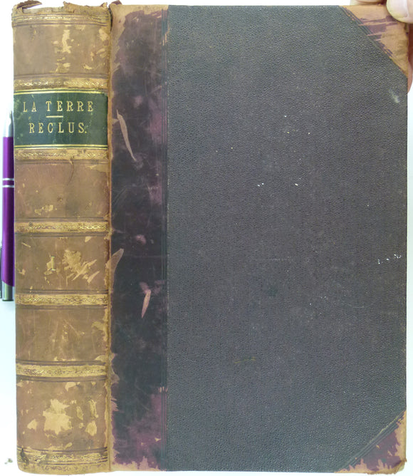
Reclus, Élisée (1870). La Terre, Description des Phènomènes de la Vie du Globe; tome 1, Les Continents. Paris: Hachette, 2nd edition. 775pp. (1st in 1868), volume 1 only of 2. Librarie Hachette.
Reclus, Élisée (1870). La Terre, Description des Phènomènes de la Vie du Globe; tome 1, Les Continents. Paris: Hachette, 2nd edition. 775pp. (1st in 1868), volume 1 only of 2...
Harris, A.L. (ed), (1985). ‘[Map of] Caledonian Igneous Rocks of Britain and Ireland’ in The Nature and Timing of Orogenic Activity in the Caledonian Rocks of the British Isles; Memoir No. 9. Geological Society of London.
Harris, A.L. (ed), (1985). ‘[Map of] Caledonian Igneous Rocks of Britain and Ireland’ in The Nature and Timing of Orogenic Activity in the Caledonian Rocks of the British Isles; Memoir...
Regular price £4500 £45.00
Morton, A.C. and Parson, L.M. (1988). Early Tertiary Volcanism and the Opening of the NE Atlantic, Geological Society Special Publication No.39. Geological Society of London.
Morton, A.C. and Parson, L.M. (1988). Early Tertiary Volcanism and the Opening of the NE Atlantic, Geological Society Special Publication No.39. Oxford: Blackwell for GSL, 1st edition. 477pp. Hardback, brown...
Regular price £3000 £30.00
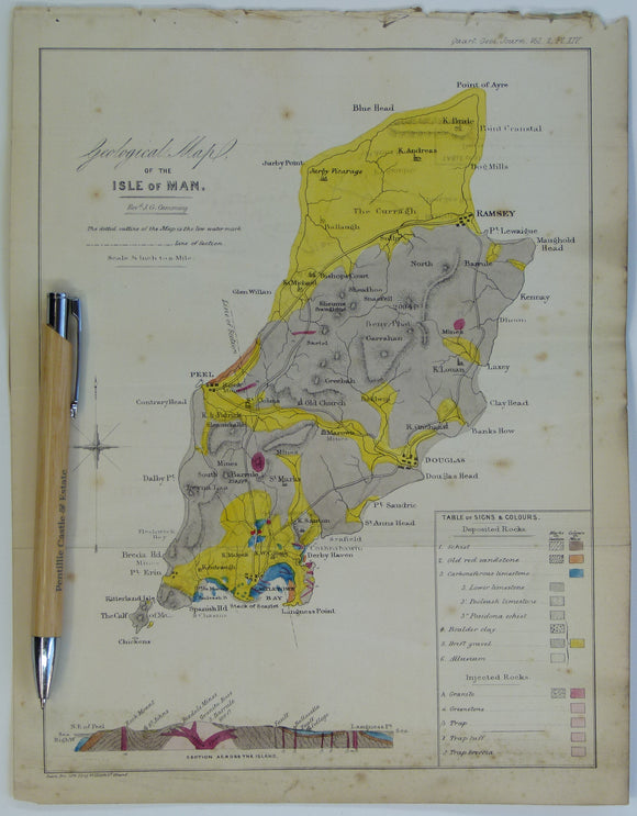
Cummings J.G. (1845). ‘Geological Map of the Isle of Man’ in ‘On the Geology of the Isle of Man’ extract from the Proc Geol Soc. London. V2, pp.317-348. Hand-coloured lithograph,. Geological Society of London.
Cummings J.G. (1845). ‘Geological Map of the Isle of Man’ in ‘On the Geology of the Isle of Man’ extract from the Proceedings of the Geological Society. London. V2, pp.317-348....
Regular price £2900 £29.00
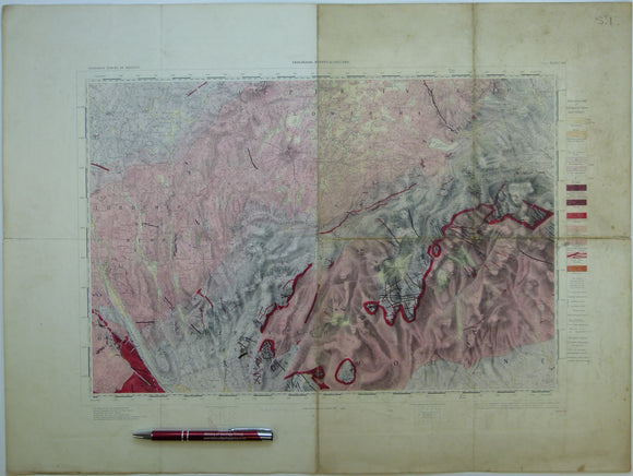
Ireland sheet 60, Newry, 1” scale. 1901. Covers Keady, Slieve Gullion. Base map 1874. Hand-coloured. Geological Survey of Ireland.
Ireland sheet 60, Newry, 1” scale. 1901. Covers Keady, Slieve Gullion. Base map 1874. Hand-coloured engraving, flat, 45 x 61cm. faint plate mark, old folds show. Pale colours, soiled and...
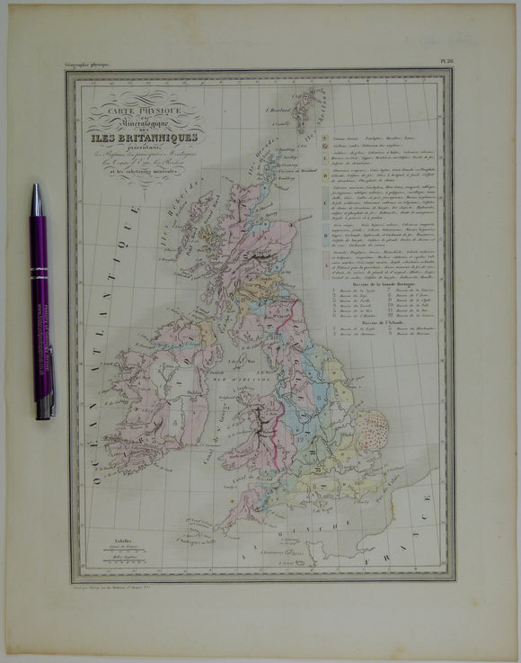
Carte Physique et Mineralogique des Îles Britanniques, 1843. Thierry.
Carte Physique et Mineralogique des Îles Britanniques, 1843, first edition. Scale 1"=70mi. Engraved, colour wash 15"x12", actual map area 12"x9". In very good condition: flat, a good graphic with pale...
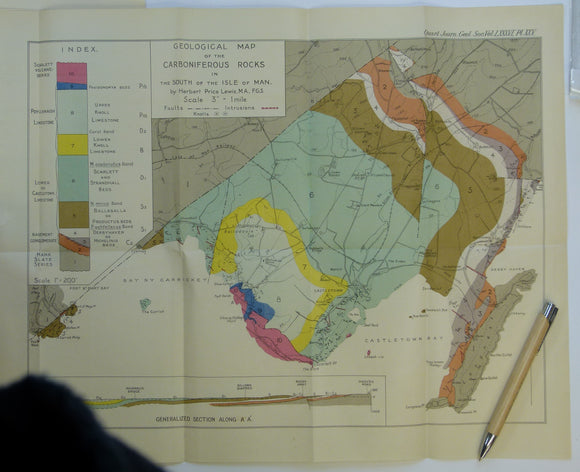
Lewis, H.P. (1930). ‘Geological Map of the Carboniferous Rocks in the South of the Isle of Man’, colour printed fold-out map, 1:21,120 scale,. Geological Society of London.
Lewis, H.P. (1930). ‘Geological Map of the Carboniferous Rocks in the South of the Isle of Man’, colour printed fold-out map, 1:21,120 scale, 36 x 46cm, from ‘The Avonian Succession...
Regular price £1600 £16.00
Harker, Alfred (1909). The Natural History of Igneous Rocks. London: Methuen, 1st edition. xvi + 384pp. Hardback, Rebacked,. Methuen.
Harker, Alfred (1909). The Natural History of Igneous Rocks. London: Methuen, 1st edition. xvi + 384pp. Hardback, Rebacked, green cloth-covered embossed boards with original spine with gilt lettering retained, moderate...
Regular price £1500 £15.00
Smith, William. (1820). REPRO Geological Map of England and Wales. Reproduction by British Geological Survey. 87 x 66 cm (original size). British Geological Survey.
Smith, William. (1820). REPRO Geological Map of England and Wales, with the Inland Navigations; exhibiting The Districts of Coal and Other Sites of Mineral Tonnage. Reproduction by British Geological Survey....
Regular price £1200 £12.00
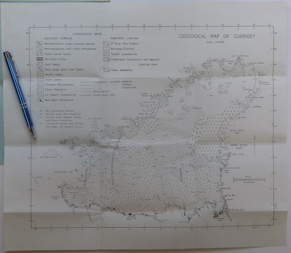
Roach, RA, (1958). ‘Geological Map of Guernsey’. 1:20,000 scale, 35.5 x 37.5cm, folded uncoloured map. La Societe Guernesiaise.
Roach, RA, (1958). ‘Geological Map of Guernsey’. 1:20,000 scale, 35.5 x 37.5cm, folded uncoloured map tipped in at back of text of Outline and Guide to the Geology of Guernsey...
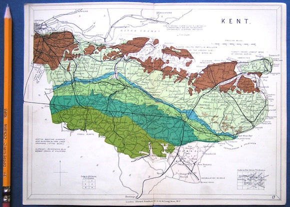
Kent (1913) county geological map from Stanford’s Geological Atlas of Great Britain and Ireland, 3rd edition. Stanford's and Reynolds' Atlases.
Kent (1913) county geological map from Stanford’s Geological Atlas of Great Britain and Ireland, 3rd edition. Approx. 1:480,000 scale. Colour printed map 16.5 x 25cm with centre fold, in good...
Regular price £1000 £10.00
Harris, A.L. et al. (1979). The Caledonides of the British Isles – Reviewed. Edinburgh: Scottish Academic Press. Scottish Academic Press.
Harris, A.L. et al. (1979). The Caledonides of the British Isles – Reviewed. Edinburgh: Scottish Academic Press for Geological Society Special Publication No. 8., 1st ed., 768 + xii pp....
Regular price £900 £9.00


![Harris, A.L. (ed), (1985). ‘[Map of] Caledonian Igneous Rocks of Britain and Ireland’ in The Nature and Timing of Orogenic Activity in the Caledonian Rocks of the British Isles; Memoir No. 9.](http://geolmaps.com/cdn/shop/files/Harris_1_{width}x.jpg?v=1705424303)
![Harris, A.L. (ed), (1985). ‘[Map of] Caledonian Igneous Rocks of Britain and Ireland’ in The Nature and Timing of Orogenic Activity in the Caledonian Rocks of the British Isles; Memoir No. 9.](http://geolmaps.com/cdn/shop/files/Harris_1_580x.jpg?v=1705424303)