Free UK postage
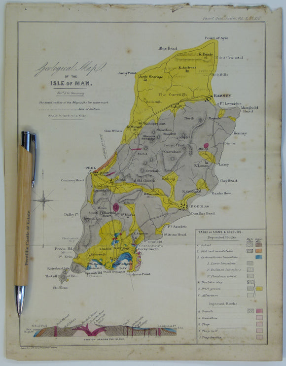
Cummings J.G. (1845). ‘Geological Map of the Isle of Man’ in ‘On the Geology of the Isle of Man’ extract from the Proc Geol Soc. London. V2, pp.317-348. Hand-coloured lithograph,. Geological Society of London.
Cummings J.G. (1845). ‘Geological Map of the Isle of Man’ in ‘On the Geology of the Isle of Man’ extract from the Proceedings of the Geological Society. London. V2, pp.317-348....
Regular price £2900 £29.00
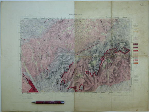
Ireland sheet 60, Newry, 1” scale. 1901. Covers Keady, Slieve Gullion. Base map 1874. Hand-coloured. Geological Survey of Ireland.
Ireland sheet 60, Newry, 1” scale. 1901. Covers Keady, Slieve Gullion. Base map 1874. Hand-coloured engraving, flat, 45 x 61cm. faint plate mark, old folds show. Pale colours, soiled and...
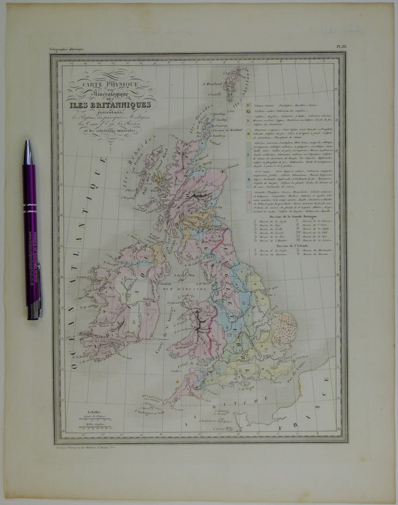
Carte Physique et Mineralogique des Îles Britanniques, 1843. Thierry.
Carte Physique et Mineralogique des Îles Britanniques, 1843, first edition. Scale 1"=70mi. Engraved, colour wash 15"x12", actual map area 12"x9". In very good condition: flat, a good graphic with pale...
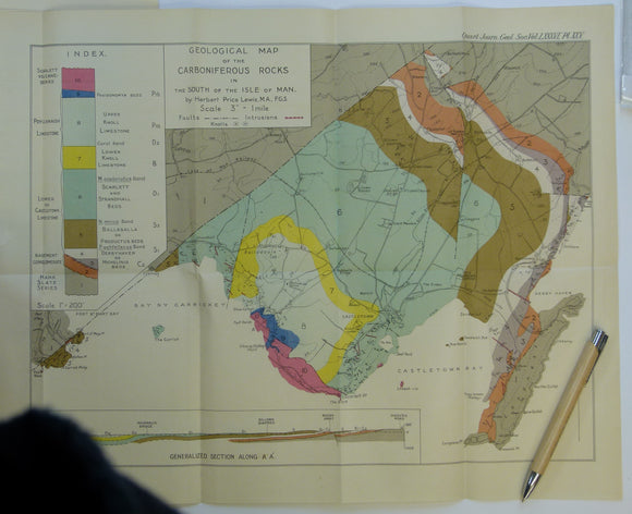
Lewis, H.P. (1930). ‘Geological Map of the Carboniferous Rocks in the South of the Isle of Man’, colour printed fold-out map, 1:21,120 scale,. Geological Society of London.
Lewis, H.P. (1930). ‘Geological Map of the Carboniferous Rocks in the South of the Isle of Man’, colour printed fold-out map, 1:21,120 scale, 36 x 46cm, from ‘The Avonian Succession...
Regular price £1600 £16.00