
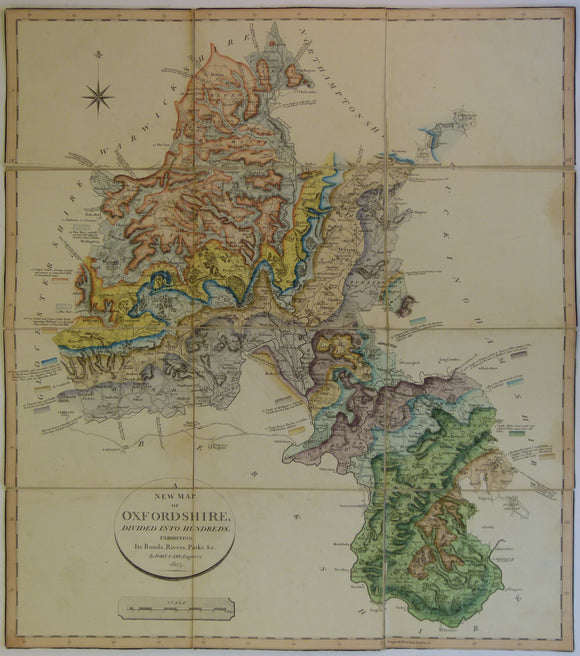


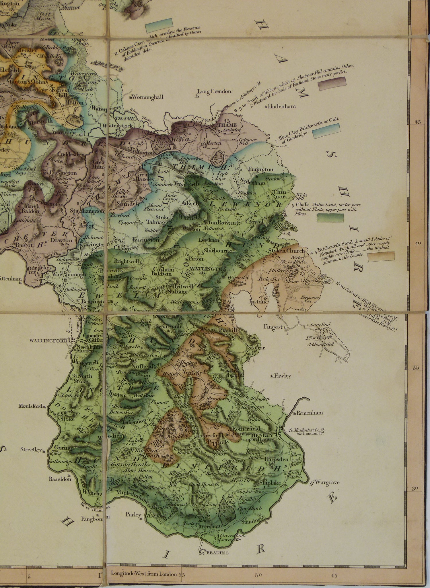


William Smith. 1823. Geological Map of Oxfordshire. Hand-coloured engraving, 54x58cm, dissected
William Smith. 1823. Geological Map of Oxfordshire. Hand-coloured engraving, 54 x 58cm, dissected and mounted on linen to fold and store in original owner’s sleeve, 17 x 14cm. 1:7,920 (1in = 2.5 miles). Clean with bright colours. Trimmed to border with loss of loss of geological title that was in top border. Cary’s original title cartouche and scale bar are present within map border. This is a rare map in very good condition, but rated as good due to trimming of title and priced accordingly.
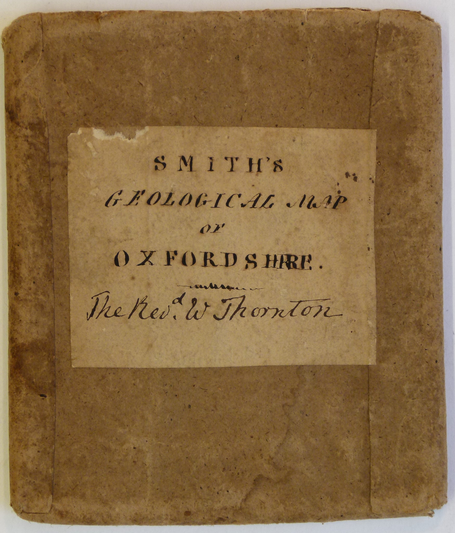
Cary engraved existing copper plates, for maps in his Cary’s New English Atlas; Being a Complete set of County Maps, with geological boundaries and tablets of colour placed around the map near the relevant geological formation instead of in a conventional legend. The original owner, Rev. W. Thornbury was located in Northampton where Smith died and was buried.