
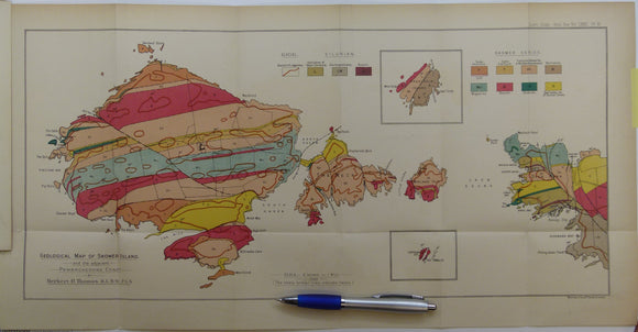


Thomas, Herbert Thomas. (1911). ‘Geological Map of Skomer Island’, fold out colour printed map, 1:10,560
Thomas, Herbert Thomas. (1911). ‘Geological Map of Skomer Island’, fold out colour printed map, 1:10,560 (6”=1 mile) from ‘The Skomer Volcanic Series (Pembrokeshire) [South Wales]’ extract from the Quarterly Journal of the Geological Society. v.67, pp.175-212. Map and text age-toned, clean. All in very good condition.