
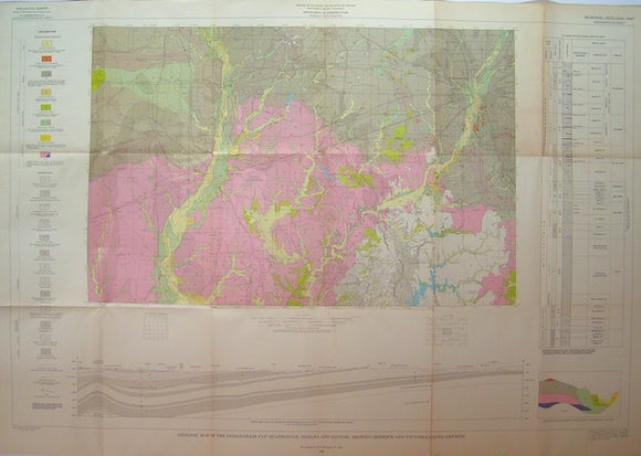
Geologic Map of the Indianapolis 1°x2° Quadrangle, Indiana and Illinois, Showing Bedrock and Unconsolidated Deposits, 1961
Geologic Map of the Indianapolis 1°x2° Quadrangle, Indiana and Illinois, Showing Bedrock and Unconsolidated Deposits, 1961, by Weir, CE and Gray, HH for the Indiana Dept of Conservation with Cooperation of the Illinois State Geological Survey. Scale 1:250,000. Folded colour print, 29"x41.5". The map also covers Terre Haute and Bloomington. The area is totally covered by drift represented by colour while the underlying bedrock is indicated by patterns. The northeast corner, which is folded to face outwards, is slightly age toned. Otherwise the map is clean, bright and in good condition.