


Bailey, Edward B, (1910), ‘Geological Map of the District Lying Between Loch Linnhe and the Moor of Rannoch and Etive Granites
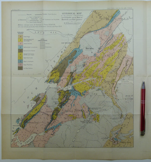
Bailey, Edward B, (1910), ‘Geological Map of the District Lying Between Loch Linnhe and the Moor of Rannoch and Etive Granites’. Fold-out colour printed geological map and section, 1:126,720 (2 miles to an inch), 40.5 x 35.5cm in ‘Recumbent Forms in the Schists of the Scottish Highlands’ (Argyllshire)’ extract from Quarterly Journal of the Geological Society, v.71, pp. 586-619. Also two fold-out b/w sections, located on map, at 1:63,360. Map, sections, and text age-toned, clean. In very good condition.