
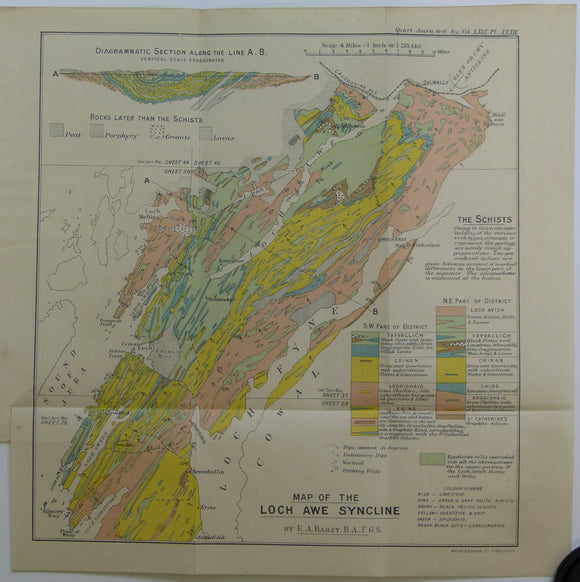


Bailey, Edward B, (1913), ‘Map of the Loch Awe Syncline’. Fold-out colour printed geological map and section
Bailey, Edward B, (1913), ‘Map of the Loch Awe Syncline’. Fold-out colour printed geological map and section, 1:253,440 (4 miles to an inch), 28 x 28cm in ‘The the Loch Awe Syncline’ (Argyllshire)’ extract from Quarterly Journal of the Geological Society, v.65, pp. 280-307. Map and text age-toned, clean. In very good condition.