
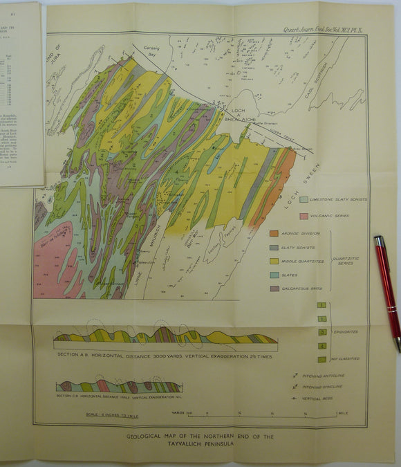


Elles, Gertrude L., (1934). ‘Geological Map of the Northern End of the Tayvallich Peninsula’ fold-out colour printed map 1:10,560
Elles, Gertrude L., (1934). ‘Geological Map of the Northern End of the Tayvallich Peninsula’ fold-out colour printed map 1:10,560, 52.5x44cm in ‘The Loch Na Cille Boulder Bed and its Place in the Highland Succession’, extract from Quarterly Journal of the Geological Society, v.91, pp. 111-149. Map and text age-toned, clean. In very good condition.