
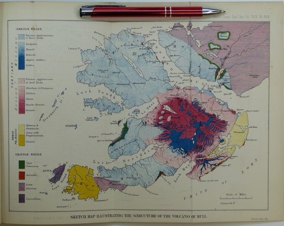
Judd, John W., (1874), ‘Sketch Map Illustrating the Structure of the Volcano of Mull. Fold-out colour printed geological map
Judd, John W., (1874), ‘Sketch Map Illustrating the Structure of the Volcano of Mull. Fold-out colour printed geological map, 1:126,720 (2 miles to 1 inch), 20.5x 29.5cm in ‘The Secondary Rocks of Scotland’ (Second paper), extract from Quarterly Journal of the Geological Society, v.30, pp. 220-302. Also fold-out colour printed ‘Sections Illustrating the Relations of the Volcanic Rocks in the Islands of Mull and Rum’, scales variable, 21.5 x 39.5cm . Map, Sections, and text age-toned, clean. In very good condition.