
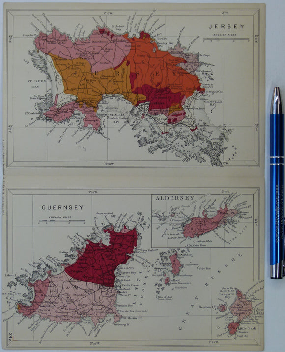
Channel Islands (1913) geological map from Stanford’s Geological Atlas of Great Britain and Ireland, 3rd edition
Channel Islands (1913) geological map from Stanford’s Geological Atlas of Great Britain and Ireland, 3rd edition. Approx. 1:160,000 scale. Colour printed maps of Jersey, Guernsey, Alderney and Sark, 16.5 x 25cm with centre fold, in good condition. Narrow margins. In the original publication the legend for all maps in the atlas, folded out so that it could be read with each map. A colour reproduction of the legend is included.