
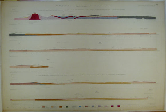


Horizontal Section No. 54 (1859). The Wrekin, Coalbrook Dale Coalfield, to Baggeridge Wood, S of Wolverhampton. 2. Through Bridgenorth and Claverly Shropshire, to Oreton Hill, S. Staffs. Geological Survey of GB. 1st
Horizontal Section No. 54 (1859). From NW to SE, across the Wrekin, Coalbrook Dale Coalfield, to Becksbury, Paddingham and Orton Hill, to Baggeridge Wood, S of Wolverhampton. 2. From W to E, through Bridgenorth and Claverly Shropshire, to Oreton Hill, S. Staffs. Geological Survey of GB. 1st edition. Located on Old Series one-inch maps 61ne & se, and 62nw & sw. Hand coloured engraving 70 x 102cm, 1:10,560 scale (6”= 1mile). Flat, Flat, age-toned, slightly soiled. In good condition.
About England & Wales Sections
These hand-coloured engraved ‘horizontal’ sections at six inch to one mile scale were published in the mid 19th century by the Geological Survey of England and Wales. The detailed profiles generally follow the geological dip on the one inch Old Series maps numbered in the upper right hand margin and the profile locations are shown on these maps which themselves did not include a section.