
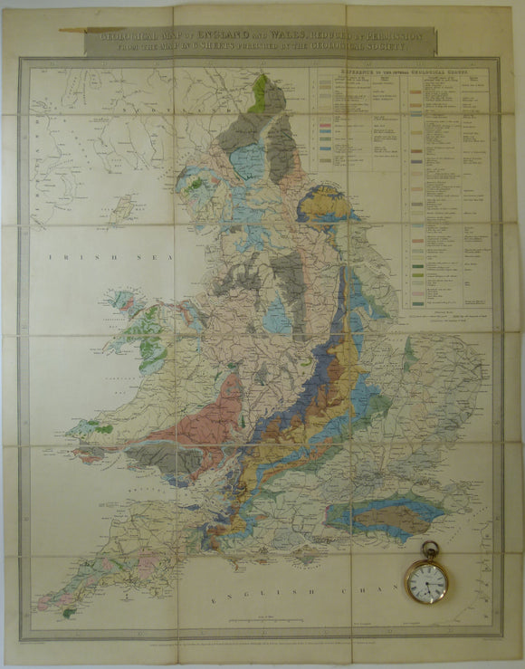

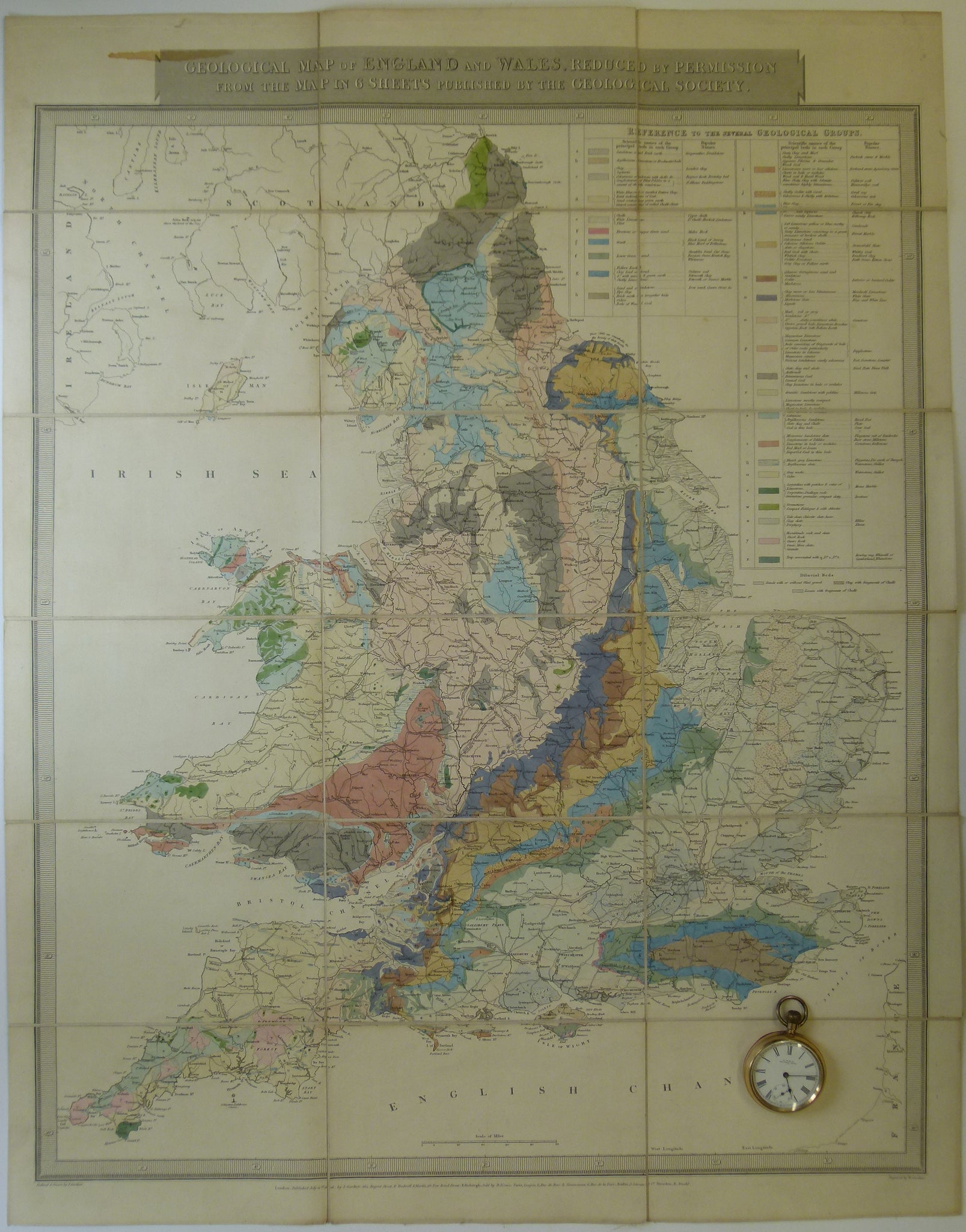
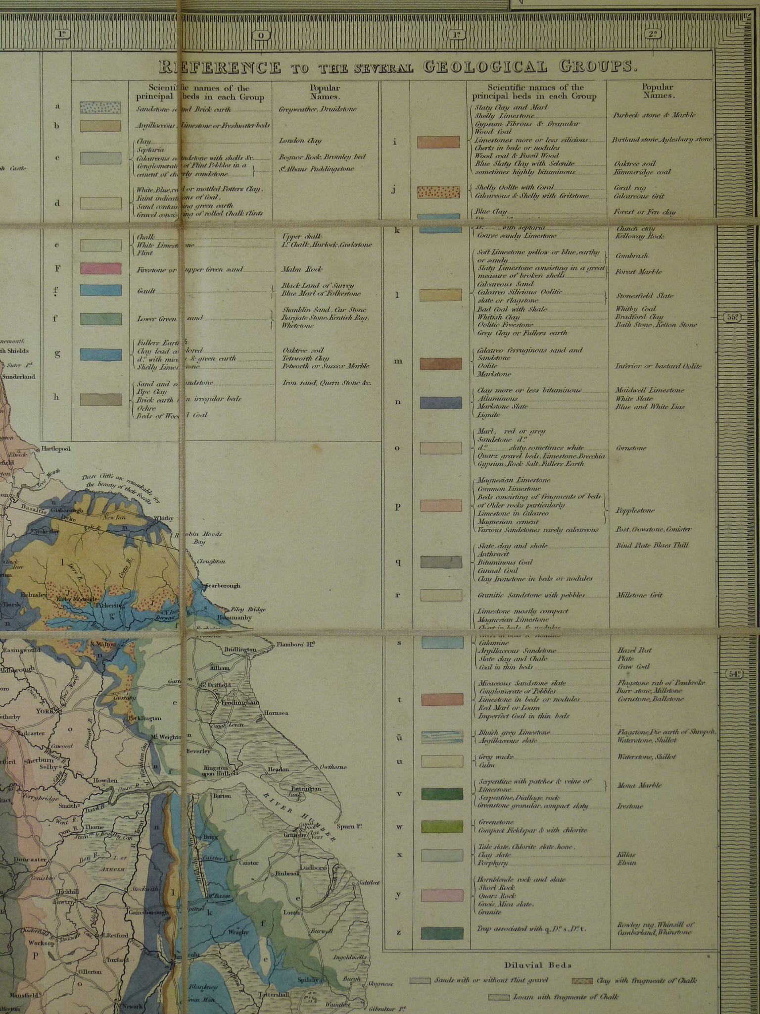
Gardner, J. 1826. Geological Map of England and Wales, Reduced from the Map in 6 Sheets Published by the Geological Society
Gardner, J. 1826. Geological Map of England and Wales, Reduced by Permission from the Map in 6 Sheets Published by the Geological Society. Published J.Gardner, London. Date on map. Approx scale 1”=12.5 miles (1:792,000). Hand coloured engraving, 73 x 57cm, dissected and mounted on linen folding to 19 x 21cm. Age-toned, colours legible but somewhat faded, lifting of panels at corners, occasional pinholes in linen at fold intersections, but otherwise linen is sound. Red diamonds indicate intended outside facing panels when folded. In fair to good condition.