


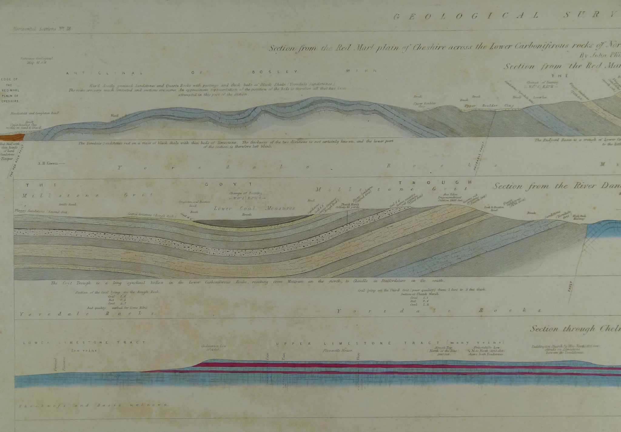

Horizontal Section No. 18 (1866) Cheshire, N Staffs, Derbyshire Coalfield, Bolsover, R. Dane, to Axe Edge, Chelmerton Low, Taddington, Ashford, Chatsworth Park, Eastmoor Chesterfield.
Horizontal Section No. 18 (1866) From the Red-Marl plain of Cheshire, across North Staffordshire and the Coalfield of Derbyshire, to near Bolsover [2] From the Red-Marl plain of Cheshire to the River Dane. From the River Dane through the Axe Edge towards Chelmerton Low. From Chelmerton Low by Taddington to Ashford. From Ashford, across Chatsworth Park and Eastmoor. From Eastmoor to Chesterfield. From Chesterfield to Bolsover. Geological Survey of GB. 2nd edition/ substantial revision with new information. Located on Old Series one-inch maps 81se &sw, and 82sw. Hand coloured engraving 68.5 x 101.5cm, 1:10,560 scale (6”= 1mile), flat. Library stamps, stencilled sheet no in lower left corner. Slightly soiled. In good condition.
About England & Wales Sections
These hand-coloured engraved ‘horizontal’ sections at six inch to one mile scale were published in the mid 19th century by the Geological Survey of England and Wales. The detailed profiles generally follow the geological dip on the one inch Old Series maps numbered in the upper right hand margin and the profile locations are shown on these maps which themselves did not include a section.