
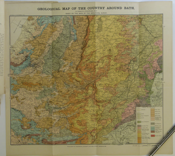


Bath. Geological Map of the Country Around Bath (c.1900.). Horace B Woodward. Folded, colour printed map 42 x 46cm, 1” = 2 miles,
Bath. Geological Map of the Country Around Bath (c.1900.). Horace B Woodward. Folded, colour printed map 42 x 46cm, 1” = 2 miles, tipped into accompanying extract ‘La Géologie des Environs de Bath’ (c.1900). Map bright and in very good condition. Together with another extract HB Woodward, La Géologie de la Vallée de Wardour, a translation from Proceedings of Geologists’ Association, v7, 1896. Both extracts stapled together, age-toned, chipped edges, in fair to good condition. The map of Bath was originally prepared for the British Association meeting in Bath in 1888. The extracts are from an unknown French journal pp. 463-471 and 472-482. Map includes Wells, Bristol, Warminster, Devizes, Malmsbury.