
England & Wales, A New Geological Map of England and Wales, with the Inland Navigations exhibiting… Reproduction.
England & Wales
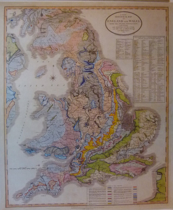
A New Geological Map of England and Wales, with the Inland Navigations exhibiting the Districts of Coal and Other Sites of Mineral Tonnage, 1820. Reproduction. Scale 1:950,400 (1 inch = 15 miles) 81 x 68cm (32 x 27.25 in.). Publ. by NERC/British Geological Survey, no date. Clean, bright and in very good condition.