
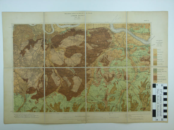


London District Sheet 4. 1” (1904). South East London, base map 1904, geologically surveyed 1903. 1:63,360 scale. Colour print.
London District Sheet 4. 1” (1904). South East London, base map 1904, geologically surveyed 1903. 1:63,360 scale. Colour print. Dissected and mounted on linen, 42 x 64cm, and folded between brown card covers, 18 x 13cm with Stanford label. Marginal note for boreholes at Erith Oil Works. In very good condition.
From a series of city centred maps published for locations divided by the layout of the New Series, which was introduced in 1900. London was covered by four sheets, originally, then by a single larger map in 1927. In England, Oxford (1908) and Nottingham (1910) had their own special sheets,