
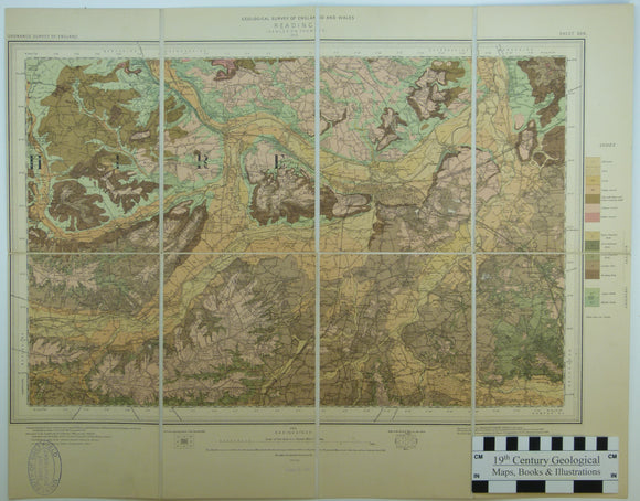


Sheet 268 New Series, Drift. 1” (1904). Reading, base map 1896, geologically surveyed 1898. 1:63,360 scale. Colour print. Dissected
Sheet 268 New Series, Drift. 1” (1904). Reading, base map 1896, geologically surveyed 1898. 1:63,360 scale. Colour print. Dissected and mounted on linen, 43 x 55cm, and folded between blue marbled card covers, 22 x 14cm. Clean, bright colours, trimmed close to left border. Library stamp in lower left corner. Transitional from Old to New Series, as printed without horizontal section which is characteristic of New Series but published separately in Old Series. In very good condition. Published before the introduction of the National Grid.
About the England & Wales One Inch New Series
In 1900, the Geological Survey of England and Wales, when it introduced colour printing, formally adopted the already existing New Series of the Ordnance Survey one inch to the mile topographic maps. The New Series geological maps included geological sections, although we have a few trial hand-coloured New Series maps from the 1890s without sections. The New Series had a uniform map size and a systematic sheet layout and numbering system which continues in use for geological maps to this day.
See also: Index Map for England & Wales One Inch New Series.