Free UK postage
Gloucestershire, A Geological Map of Gloucestershire, 1819. Reproduction. Smith, William.
Gloucestershire A Geological Map of Gloucestershire, 1819. Reproduction. Size reduction to 54 x 50cm (21.25 x 19.75 in). Flat white paper. Publ. by NERC/British Geological Survey, 1993. Clean, bright and...
Regular price £1100 £11.00
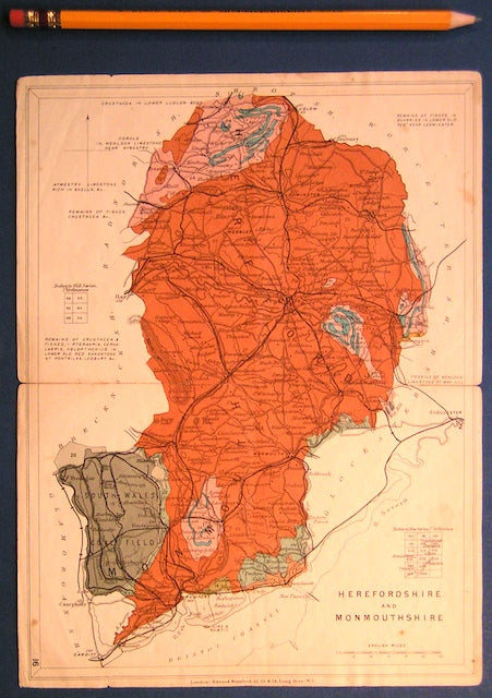
Herefordshire and Monmouthshire (now part of Wales) (1913) counties geological map from Stanford’s Geological Atlas of Great Britain and Ireland,. Stanford's and Reynolds' Atlases.
Herefordshire and Monmouthshire (now part of Wales) (1913) counties geological map from Stanford’s Geological Atlas of Great Britain and Ireland, 3rd edition. Approx. 1:480,000 scale. Colour printed map 16.5 x...
Regular price £1000 £10.00
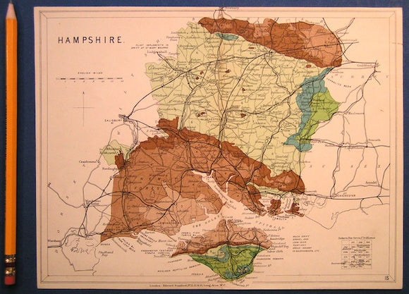
Hampshire including Isle of Wight (1913) county geological map from Stanford’s Geological Atlas of Great Britain and Ireland, 3rd ed. Stanford's and Reynolds' Atlases.
Hampshire including Isle of Wight (1913) county geological map from Stanford’s Geological Atlas of Great Britain and Ireland, 3rd edition. Approx. 1:480,000 scale. Colour printed map 16.5 x 25cm with...
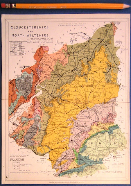
Gloucestershire and North Wiltshire (1913) county geological map from Stanford’s Geological Atlas of Great Britain and Ireland,. Stanford's Atlas.
Gloucestershire and North Wiltshire (1913) county geological map from Stanford’s Geological Atlas of Great Britain and Ireland, 3rd edition. Approx. 1:480,000 scale. Colour printed map 16.5 x 25cm with centre...
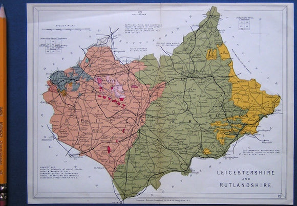
Leicestershire and Rutlandshire (1913) counties geological map from Stanford’s Geological Atlas of Great Britain and Ireland, 3rd edition. Stanford's and Reynolds' Atlases.
Leicestershire and Rutlandshire (1913) counties geological map from Stanford’s Geological Atlas of Great Britain and Ireland, 3rd edition. Approx. 1:350,000 scale. Colour printed map 16.5 x 25cm with centre fold,...
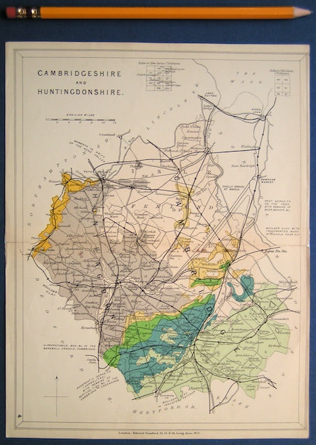
Cambridgeshire and Huntingdonshire (1913) counties geological map from Stanford’s Geological Atlas of Great Britain and Ireland, 3rd edition. Stanford's and Reynolds' Atlases.
Cambridgeshire and Huntingdonshire (1913) counties geological map from Stanford’s Geological Atlas of Great Britain and Ireland, 3rd edition. Approx. 1:480,000 scale. Colour printed map 16.5 x 25cm with centre fold,...
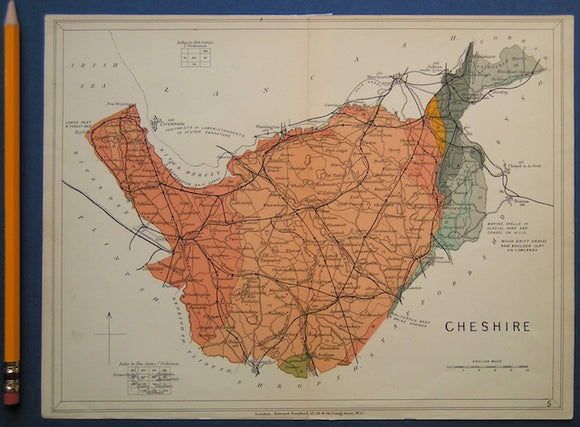
Cheshire (1913) counties geological map from Stanford’s Geological Atlas of Great Britain and Ireland, 3rd edition. Stanford's and Reynolds' Atlases.
Cheshire (1913) counties geological map from Stanford’s Geological Atlas of Great Britain and Ireland, 3rd edition. Approx. 1:480,000 scale. Colour printed map 16.5 x 25cm with centre fold, in good...
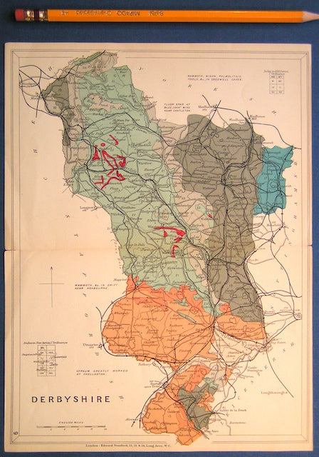
Derbyshire (1913) county geological map from Stanford’s Geological Atlas of Great Britain and Ireland, 3rd edition. Stanford's and Reynolds' Atlases.
Derbyshire (1913) county geological map from Stanford’s Geological Atlas of Great Britain and Ireland, 3rd edition. Approx. 1:480,000 scale. Colour printed map 16.5 x 25cm with centre fold, in good...
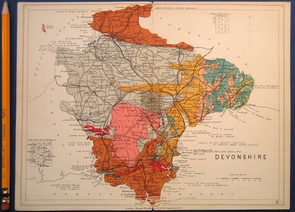
Devon (1913) county geological map from Stanford’s Geological Atlas of Great Britain and Ireland, 3rd edition. Stanford's and Reynolds' Atlases.
Devon (1913) county geological map from Stanford’s Geological Atlas of Great Britain and Ireland, 3rd edition. Approx. 1:640,000 scale. Colour printed map 16.5 x 25cm with centre fold, in good...
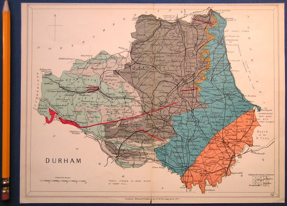
Durham (1913) county geological map from Stanford’s Geological Atlas of Great Britain and Ireland, 3rd edition. Stanford's and Reynolds' Atlases.
Durham (1913) county geological map from Stanford’s Geological Atlas of Great Britain and Ireland, 3rd edition. Approx. 1:350,000 scale. Colour printed map 16.5 x 25cm with centre fold, in good...
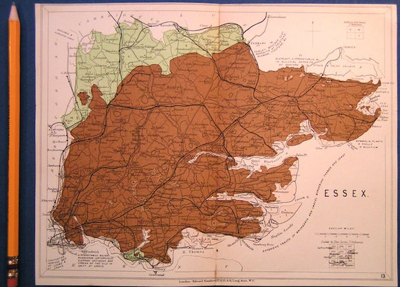
Essex (1913) county geological map from Stanford’s Geological Atlas of Great Britain and Ireland, 3rd edition. Stanford's and Reynolds' Atlases.
Essex (1913) county geological map from Stanford’s Geological Atlas of Great Britain and Ireland, 3rd edition. Approx. 1:480,000 scale. Colour printed map 16.5 x 25cm with centre fold, in good...
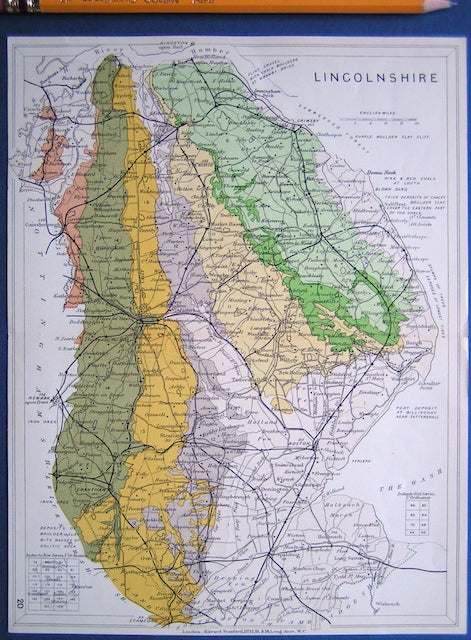
Lincolnshire (1913) county geological map from Stanford’s Geological Atlas of Great Britain and Ireland, 3rd edition. Stanford's and Reynolds' Atlases.
Lincolnshire (1913) county geological map from Stanford’s Geological Atlas of Great Britain and Ireland, 3rd edition. Approx. 1:480,000 scale. Colour printed map 16.5 x 25cm with centre fold, in good...
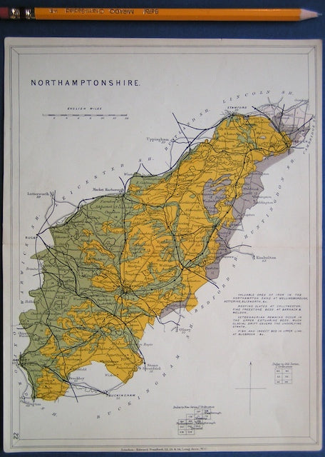
Northamptonshire (1913) county geological map from Stanford’s Geological Atlas of Great Britain and Ireland, 3rd edition. Stanford's and Reynolds' Atlases.
Northamptonshire (1913) county geological map from Stanford’s Geological Atlas of Great Britain and Ireland, 3rd edition. Approx. 1:480,000 scale. Colour printed map 16.5 x 25cm with centre fold, in good...
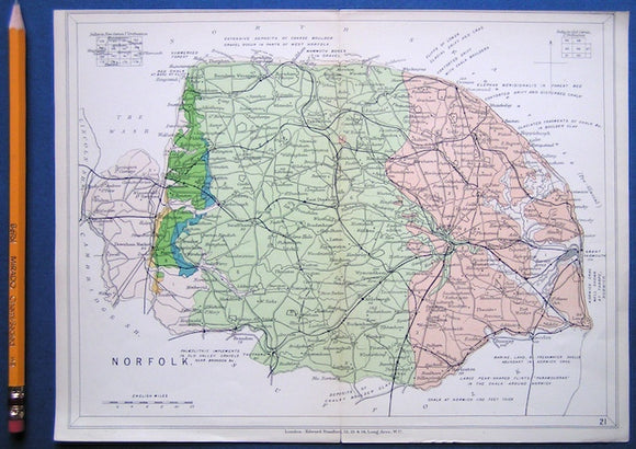
NorfolkNorfolk (1913) county geological map from Stanford’s Geological Atlas of Great Britain and Ireland, 3rd edition. Stanford's and Reynolds' Atlases.
Norfolk (1913) county geological map from Stanford’s Geological Atlas of Great Britain and Ireland, 3rd edition. Approx. 1:480,000 scale. Colour printed map 16.5 x 25cm with centre fold, in good...
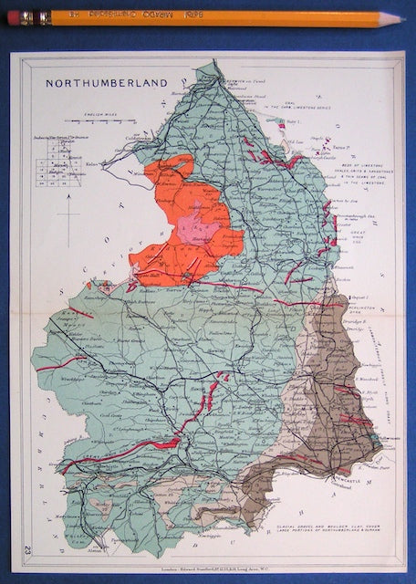
Northumberland (1913) county geological map from Stanford’s Geological Atlas of Great Britain and Ireland, 3rd edition. Stanford's and Reynolds' Atlases.
Northumberland (1913) county geological map from Stanford’s Geological Atlas of Great Britain and Ireland, 3rd edition. Approx. 1:350,000 scale. Colour printed map 16.5 x 25cm with centre fold, in good...
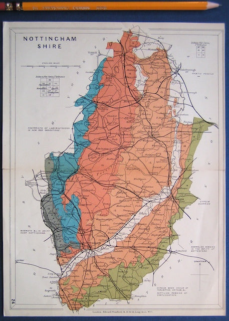
Nottinghamshire (1913) county geological map from Stanford’s Geological Atlas of Great Britain and Ireland, 3rd edition. Stanford's and Reynolds' Atlases.
Nottinghamshire (1913) county geological map from Stanford’s Geological Atlas of Great Britain and Ireland, 3rd edition. Approx. 1:350,000 scale. Colour printed map 16.5 x 25cm with centre fold, in good...
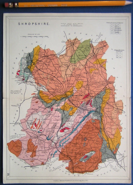
Shropshire (1913) county geological map from Stanford’s Geological Atlas of Great Britain and Ireland, 3rd edition. Stanford's and Reynolds' Atlases.
Shropshire (1913) county geological map from Stanford’s Geological Atlas of Great Britain and Ireland, 3rd edition. Approx. 1:480,000 scale. Colour printed map 16.5 x 25cm with centre fold, in good...
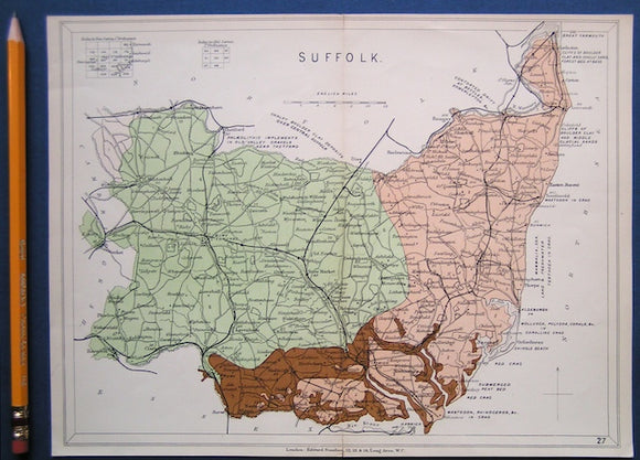
Suffolk (1913) county geological map from Stanford’s Geological Atlas of Great Britain and Ireland, 3rd edition. Stanford's and Reynolds' Atlases.
Suffolk (1913) county geological map from Stanford’s Geological Atlas of Great Britain and Ireland, 3rd edition. Approx. 1:480,000 scale. Colour printed map 16.5 x 25cm with centre fold, in good...
Bedfordshire, Buckinghamshire, Hertfordshire and Middlesex (1913) counties geological map from Stanford’s Geological Atlas. Stanford's and Reynolds' Atlases.
Bedfordshire, Buckinghamshire, Hertfordshire and Middlesex (1913) counties geological map from Stanford’s Geological Atlas of Great Britain and Ireland, 3rd edition. Approx. 1:480,000 scale. Colour printed map 16.5 x 25cm with...
Yorkshire 297 ne. Woolley Park. Surveyed 1933, issued 1939. Geological Survey of England & Wales.
Yorkshire 297 ne. Woolley Park. Surveyed 1933, issued 1939. Outline geology in blue on black basemap with red contours. Tape residue on top edge. In very good condition.