
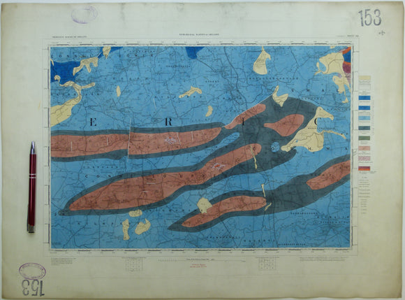


Ireland sheet 153, Rathkeale, 1” scale. 1860, first edition. Covers Ballingarry, Kilmallock. Hand-coloured
Ireland sheet 153, Rathkeale, 1” scale. 1860, first edition. Base map not dated. Coloured 1908. Covers Ballingarry, Kilmallock. Hand-coloured engraving, flat, 44.5 x 60.5cm., faint plate mark. Bright colours, very slightly soiled and age-toned. Library stamps in upper and lower left corners and stencilled numbers in upper right and lower left corners. Dark blue and grey of Carboniferous Limestones are dark and difficult to read through. In good to very good condition.
See also: Index Map for Irish One Inch Survey.