
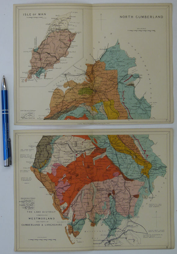
Cumberland, Westmorland counties (Lake District) and Isle of Man (1913) geological map from Stanford’s Geological Atlas of Great Britain and Ireland,
Cumberland, Westmorland counties (Lake District) and Isle of Man (1913) geological map from Stanford’s Geological Atlas of Great Britain and Ireland, 3rd edition. Approx. 1:480,000 scale. Two colour printed maps, each 16.5 x 25cm with centre fold, in good condition, comprising north and south halves which may be joined. Narrow margins. In the original publication the legend for all maps in the atlas, folded out so that it could be read with each map. A colour reproduction of the legend is included.