
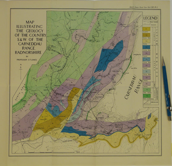
Wales Mid- 1947. Map Illustrating the Geology of the Country S.&W. of the Carneddau Range, Radnorshire, colour
Wales Mid- 1947. Map Illustrating the Geology of the Country S.&W. of the Carneddau Range, Radnorshire, colour printed folded map at 1:31,680 (2 ins =1mile) 36 x 38cm, in ‘The Geology of the Silurian rocks west and south of the Carneddau Range, Radnorshire’ extract from Quarterly Journal of the Geological Society, v103. 1947. By Owen Thomas Jones. Pp.1-36. Map and text in very good condition.