
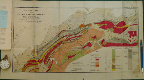
Wales North 1920. Geological Map of Arthog-Dolgelley District Merionethshire
Wales North 1920. Geological Map of Arthog-Dolgelley District Merionethshire, colour printed folded map at 1:21,120 (3 ins =1mile) 34 x 57cm, in ‘The Lower Palaeozoic Rocks of the Arthog-Dolgelley District (Merionethshire)’ extract from Quarterly Journal of the Geological Society, v76. 1920. By Arthur H Cox and Alfred K Wells. Pp.254-324. Map in fair to good condition (light coffee stains) and text in very good condition.