


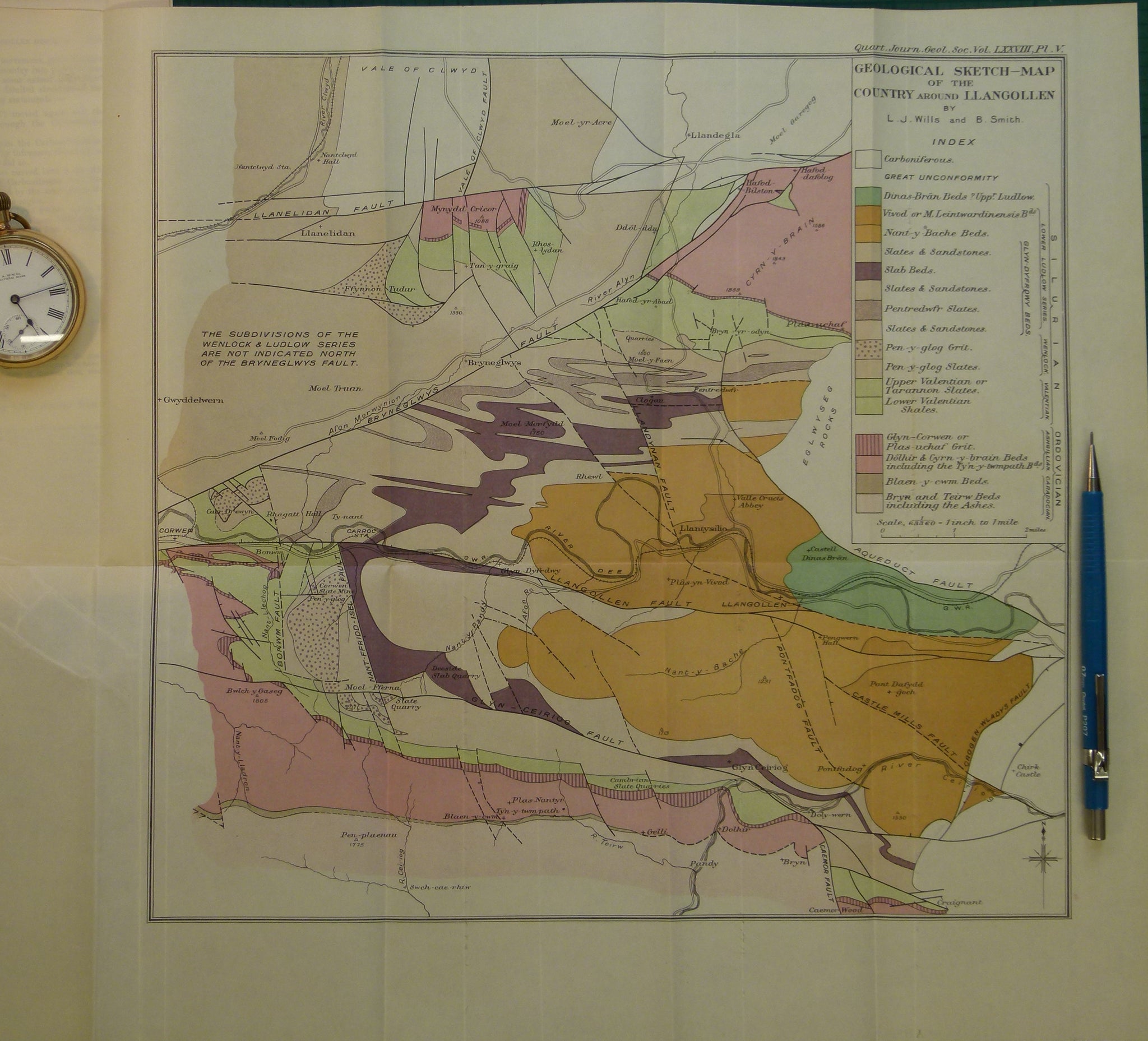
Wales North 1922. Geological Sketch-Map of the Country around Llangollen
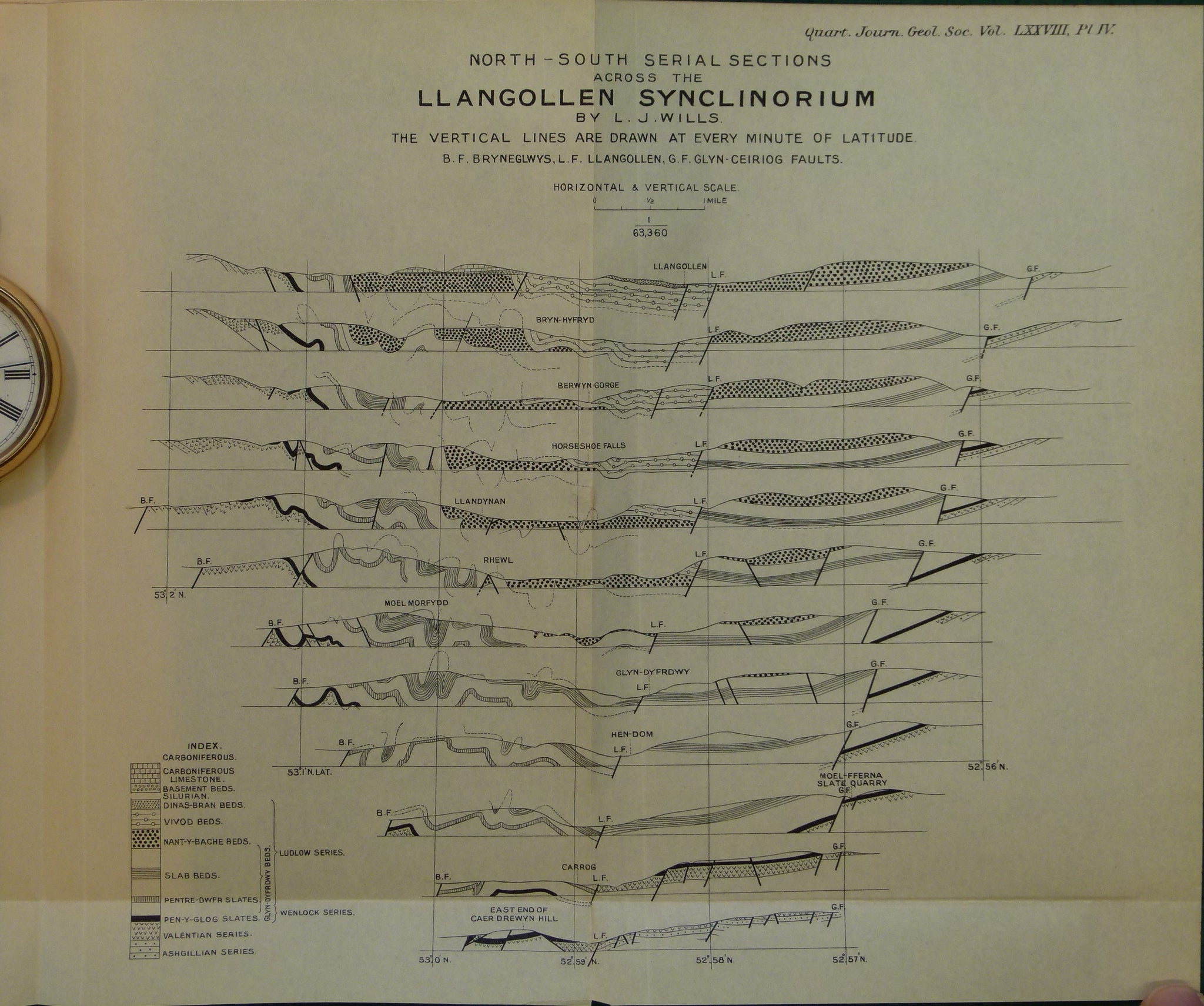
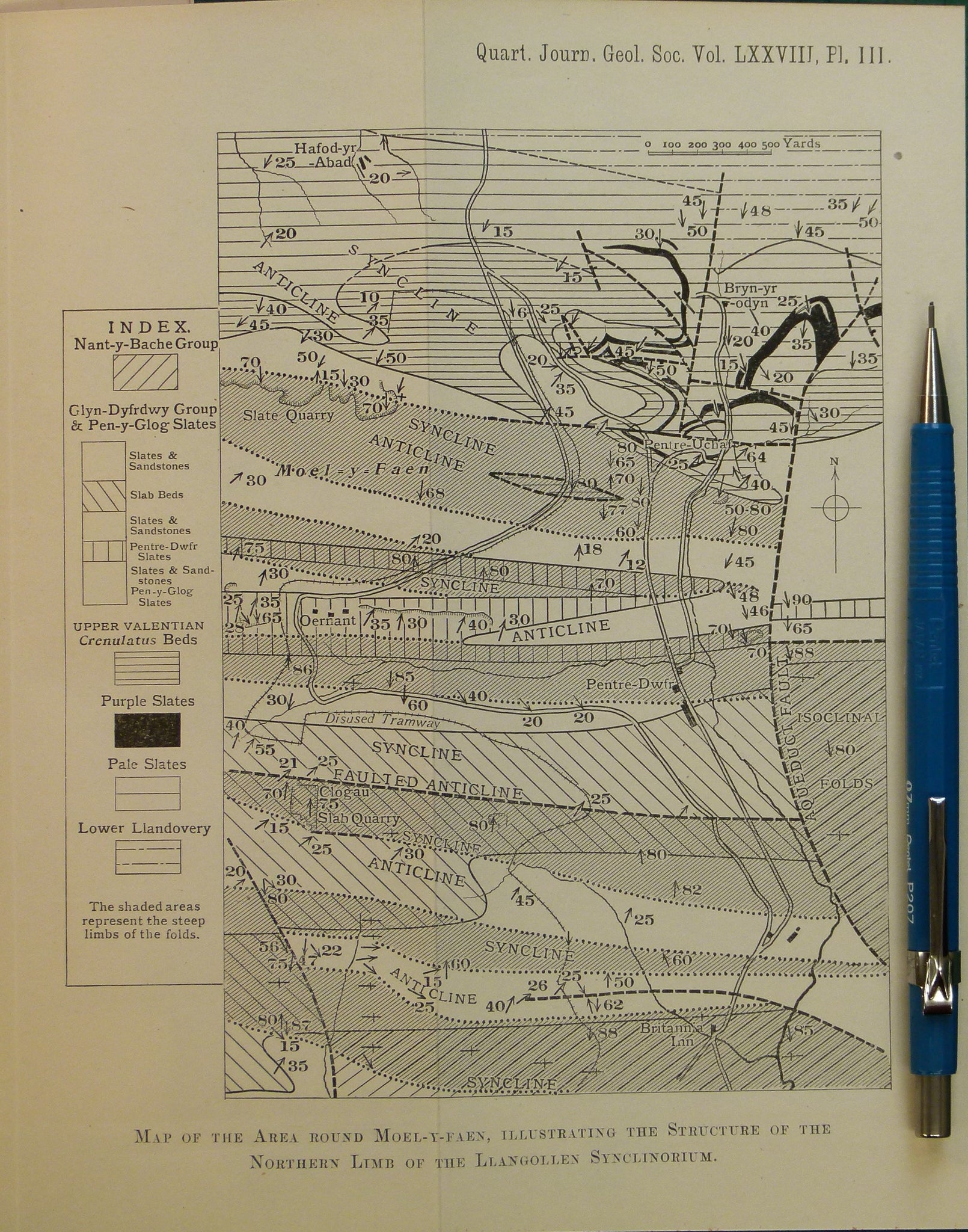
Wales North 1922. Geological Sketch-Map of the Country around Llangollen, colour printed folded map at 1:63,360 (1 in =1mile) 36 x 36.5cm, in ‘The Lower Palaeozoic Rocks of the Llangollen District, with special reference to the Tectonics’, extract from Quarterly Journal of the Geological Society, v.78. 1922. By Leonard J Wills and Bernard Smith. Pp.176-226. Additional black and white map and sections of the structure of the Llangollen Synclinorium. Maps and text in very good condition.