
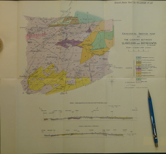
Wales North 1928. Geological Sketch-Map of the Country Between Llanelidan and Bryneglwys, colour
Wales North 1928. Geological Sketch-Map of the Country Between Llanelidan and Bryneglwys, colour printed folded map at 1:31,680 (2 ins =1mile) 38 x 37cm, in ‘The Geology of the Country between Llanelidan and Bryneglwys’, extract from Quarterly Journal of the Geological Society, v.83. 1927. By Robert C Blackie. Pp.711-736. Map and text in very good condition.