Free UK postage
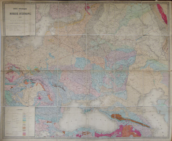
Carte Geologique de la Russie d’Europe, 1859. Approx 1:3,675,000 scale. (77 x 93.5cm) hand-coloured engraved map. Jules Guillemin.
Carte Geologique de la Russie d’Europe, 1859. Approx 1:3,675,000 scale. (77 x 93.5cm) hand-coloured engraved map by E. Andriveau-Goujon, Paris. Originally folded, then dissected and mounted on linen to fold....
Regular price £1,20000 £1,200.00
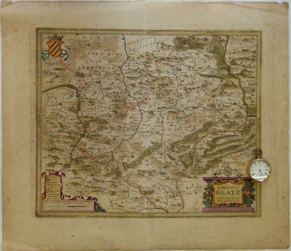
Poland. 1639. Comitatus Glatz. Authore Iona Sculteto. Henricus Hondius execudit, Amsterdam. Hand coloured engraving at 1:100,000 approx
Poland. 1639. Comitatus Glatz. Authore Iona Sculteto. Henricus Hondius execudit, Amsterdam. Hand coloured engraving at 1:100,000 approx. (4cm = 1 Millaria Germanica Communia). Glatz is now called Klodzko and is...
Regular price £20000 £200.00
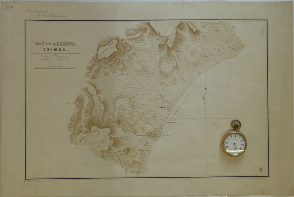
Ukraine / Russia. 1855. Bay of Alushta, Crimea; from the Survey by Captn. E. Manganari of the Russian Imperial Navy
Ukraine / Russia. 1855. Bay of Alushta, Crimea; from the Survey by Captn. E. Manganari of the Russian Imperial Navy 1836. Topographic map with offshore contours. Not geological. 1:63,360 scale...
Regular price £5000 £50.00
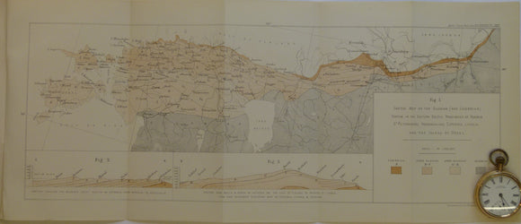
Schmidt, F. (1882). 'Sketch Map of the Silurian (and Cambrian) System in the Eastern Baltic Provinces of Russia. Geological Society of London.
Schmidt, F. (1882). 'Sketch Map of the Silurian (and Cambrian) System in the Eastern Baltic Provinces of Russia – St.Petersburg, Ingermanland, Esthonia, Livonia, and the Island of Oesel, in ‘On...
Regular price £1200 £12.00