
Carte géologique de l'Oise, 1858
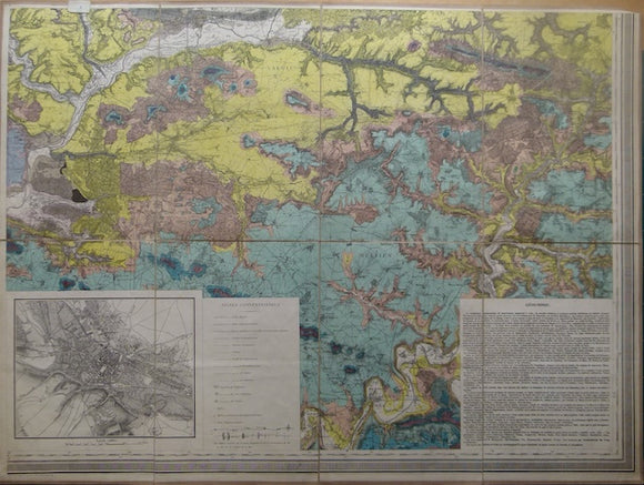
Carte géologique de l'Oise, 1858, by Passy. Scale 1:80,000, hand coloured engraved map, 65.5 x 88.5cm, cut, mounted on linen to fold to 32.5 x22cm with the labelof the map agents, Andriveau-Goujon. Southeast quarter of map issued in four sheets. The maps covers le Valois et le Multien with an inset plan de Beauvais at1:20,000. Text describing 'Geognosie' is in another inset. The legend is on another quarter sheet, but a recent A4 manuscript in biro and crayon provides the information. In good condition.