


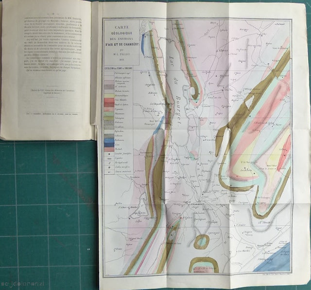

Carte Geologique des Environs de l'Aix et de Chambery, 1863
Carte Geologique des Environs de l'Aix et de Chambery, 1863 (date on map), by Louis Pillet. Plus 4 sections on copy of same map, plus Carte Agronomique, 1865 (date on map) of same area. All 46 x 34cm, scale 1:100,000, hand coloured fold out maps, in a booklet, Cartes Geologiques, by Pillet, 1865,18 pages. The essay discusses the state of geological mapping in France and advocates use of larger scales and inclusion of Quaternary deposits of which his third map is an example. He considered the omission of Quaternary deposits an 'anomalie bizzarre' and envisaged these deposits shown on a transparent overlay to the conventional solid map. Chambery is in the Savoie region. In very good condition