Free UK postage
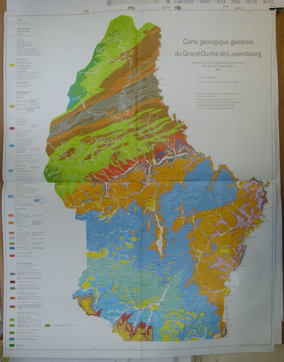
Luxemburg (1966). Carte Géologique Genérale du Grand-Duchéè de Luxembourg. Service Géologique de Luxembourg. Colour printed map, 89.5 x 70cm. 1:100,000. Geological Survey of Luxemburg.
Luxemburg (1966). Carte Géologique Genérale du Grand-Duchéè de Luxembourg. Service Géologique de Luxembourg. Colour printed map, 89.5 x 70cm. 1:100,000. Folded, clean, punched holes in top margin. Adjacent countries uncoloured....
Regular price £1200 £12.00
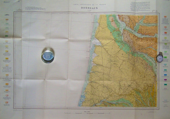
Sheet 59, Bordeaux, Carte Géologique de la France, 1967. Scale 1:320,000. Bureau de Researches Geologiques et Minieres.
Sheet 59, Bordeaux, Carte Géologique de la France, 1967. Scale 1:320,000. Colour print, 65x96.5cm (25.5" x35 ") folded. Half of map is blank as sea. Shows contours of base of...
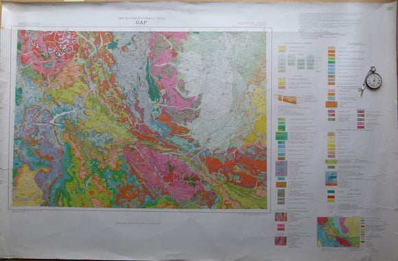
Carte Geologique de la France, 1980. Bureau de Researches Geologiques et Minieres.
Carte Geologique de la France, 1980. Scale 1:250,000. Colour print, 65 x100cm, flat with marginal tears in left margin to map border. Clean, bright. The map is in good condition
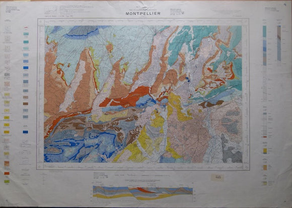
Montpelier, sheet 27-43, Carte Geologique de la France, 1971. Bureau de Researches Geologiques et Minieres.
Montpelier, sheet 27-43, Carte Geologique de la France, 1971. (re-numbered in 2nd edition, 1990 as sheet 990) Scale 1:50,000. Colour print, 60 x86cm, flat with minor marginal tears, traces of...
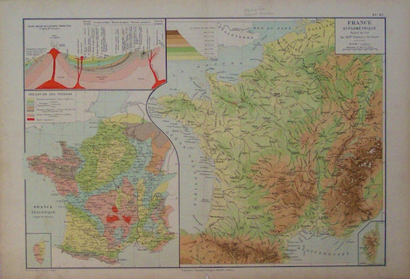
France Geologique,1889. Librarie Classique Eugene Belin, 1889.
France Geologique,1889. Scale 1:7,000,000 approx. Colour print, 33x48.5cm, with larger scale relief map of France and idealized geological section. Flat with single central fold and binding fin on reverse. One...
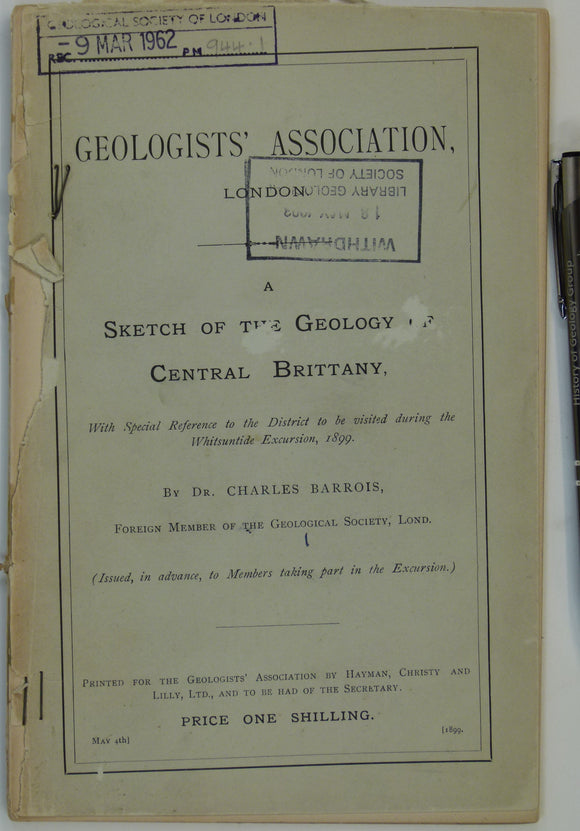
France (1899). Barrois, Charles. A Sketch of the Geology of Central Brittany . London: GA. Preprinted guide for GA Whitsuntide Excursion, 1899. Geologists' Association.
France (1899). Barrois, Charles. A Sketch of the Geology of Central Brittany . London: Geologists’ Association. Preprinted guide for GA Whitsuntide Excursion, 1899. Pp. 101-132. PB, stapled pages with library...
Regular price £1000 £10.00
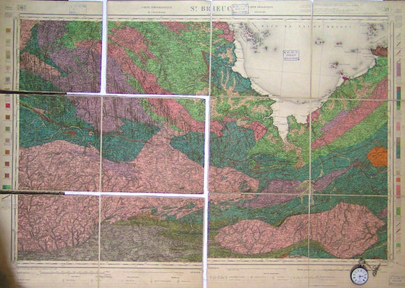
Sheet 59, St. Brieuc, Carte Géologique Détaillée, 1897. Scale 1:160,000. Bureau de Researches Geologiques et Minieres.
Sheet 59, St. Brieuc, Carte Géologique Détaillée, 1897. Scale 1:160,000. Colour print, 61x104cm (24"x35 "), cut, mounted on linen and folded. 2 library stamps in margins. Torn into 4 pieces...
Regular price £900 £9.00
Geological Map of Part of [south] France, 1869, Plate 3, from Mines and Miners; or, Underground Life by L. Simonin
Geological Map of Part of [south] France, 1869, Plate 3, from Mines and Miners; or, Underground Life by L. Simonin. London: Chapman and Hall. Colour print 17.5 x 25.5cm. Omits...
Regular price £800 £8.00
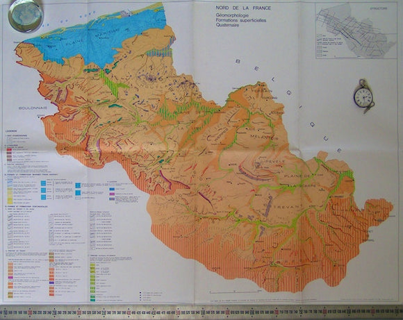
Nord de la France; Geomorphologie, Formations Superficielles Quaternaire, 1980. Sommé, A, 1980.
Nord de la France; Geomorphologie, Formations Superficielles Quaternaire, 1980. Scale 1:100,000. Covers Calais to the border with Belgium and inland as far as Cambrai. Folded 64x84cm (25"x33") in good condition.
Regular price £600 £6.00


![Geological Map of Part of [south] France, 1869, Plate 3, from Mines and Miners; or, Underground Life by L. Simonin](http://geolmaps.com/cdn/shop/products/P1080644_{width}x.JPG?v=1551269994)
![Geological Map of Part of [south] France, 1869, Plate 3, from Mines and Miners; or, Underground Life by L. Simonin](http://geolmaps.com/cdn/shop/products/P1080644_580x.JPG?v=1551269994)