
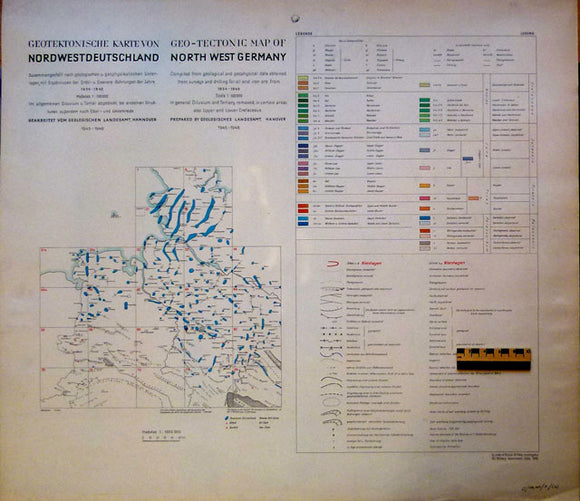
Geo-Tectonic Map of Northwest Germany, 1946
Geo-Tectonic Map of Northwest Germany, 1946 by Geolgischen Landesamt, Hannover, by order of British Oilfields Investigation 912, Military Government. Scale 1:100,000. Colour printed set of 24 abutting sheets plus title page with legend, each 69 x 79cm. Based on exploration and boreholes for coal and iron ore carried out from 1934-45. The maps show sub-Tertiary geology, principally the numerous and extensive salt domes, extending in the southwest into the Netherlands. In German and English. Clean, bright and in very good condition. Three typical sheets and key are shown; if interested in other areas please ask for photograph. Sold as a set.