
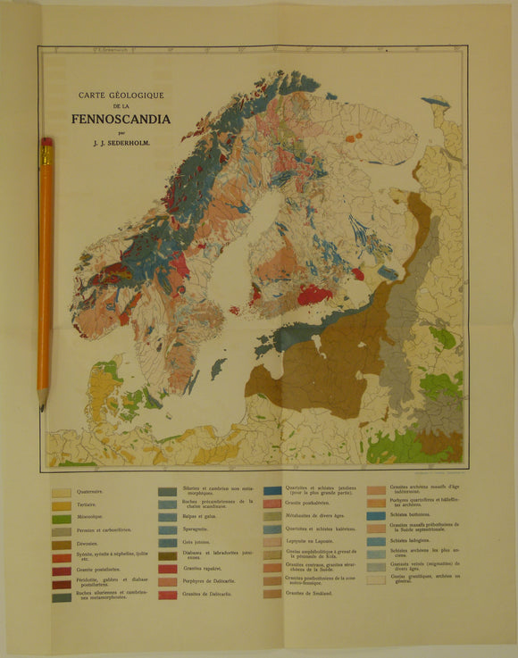
Sederholm, JJ. 1910. Carte Geologique de la Fennoscandia. Colour printed folded map (41.5 x 33cm) at 1:800,000 approx
Sederholm, JJ. 1910. Carte Geologique de la Fennoscandia. Colour printed folded map (41.5 x 33cm) at 1:800,000 approx (scale not stated) with ‘Les Roches Prequaternaires de la Fennoscandia’, Helsingfors. 39pp, from Atlas de Finlande, 1910. This map was no. 5 in the Atlas of Finland and was prepared also for the 11th Congress of the International Geological Congress which was in Stockholm in 1910. Text and map in French. On manuscript on the cover ‘with the compliments of the author’. Paper cover is torn along stapled spine. The text is clean, slightly age-toned with library stamps to cover and title page, otherwise in very good condition. The map is clean and bright and in very good condition.