


Atlas for the Geology of Szechuan Province and Eastern Sikang (for Mem.Geol.Surv.China, seies A, no.15)
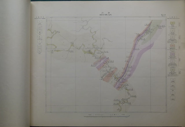
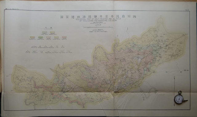
Atlas for the Geology of Szechuan Province and Eastern Sikang (for Mem.Geol.Surv.China, seies A, no.15) by HC Tab and CY Lee, Peiping, July, 1935. Atlas measures 52x72cm, with 38 colour printed maps (37 at 1:200,000 and 1 at 1:20,000) and 3 b/w printed pages of horizontal sections and well logs. An index map at 1:2m shows the location of 35 maps. The maps show the geology along river centred corridors except for the last two which show completed regions, Geological Sketch Map of the Regions of Wanhsien, Tahsien and Langshanhsien, Szechuan, and Geolgical Map of Salt Regions and Oil Field of Tzuliuching and Kungching, Scechuan. The front cover serves also as the title page, its margins are age embrittled with small chips and tears and the corners are bumped. The back cover is missing, the maps are stapled and decorative orange ribbons tie the pages together. The front 5 pages have a tear into the margin which does not affect the map area. Otherwise these maps and the rest are clean and in good to very good condition.