


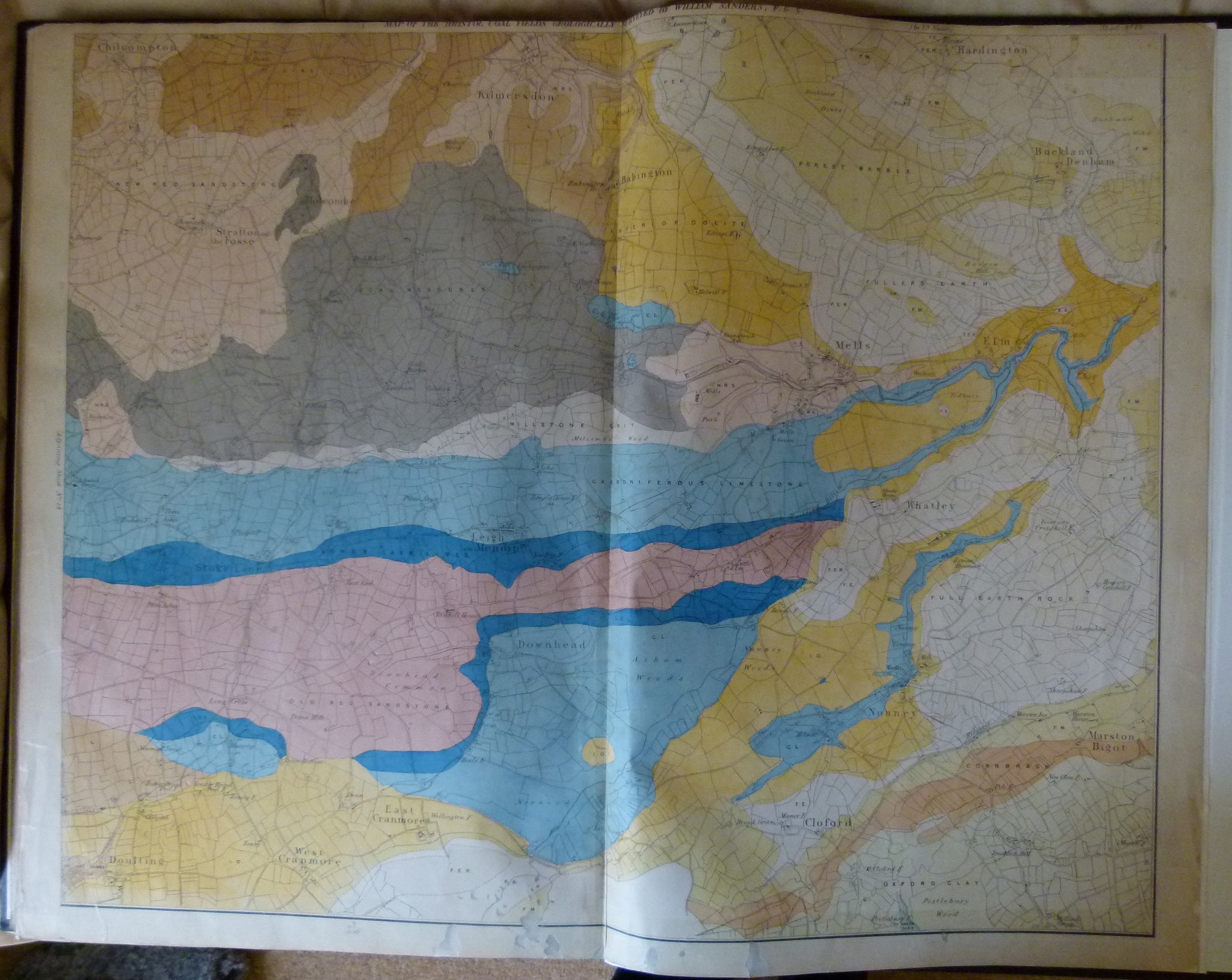
Sanders, William (1864). Map of the Bristol Coal Field and Country Adjacent in 19 Sheets, Geologically Surveyed. Hardback atlas, Rare.
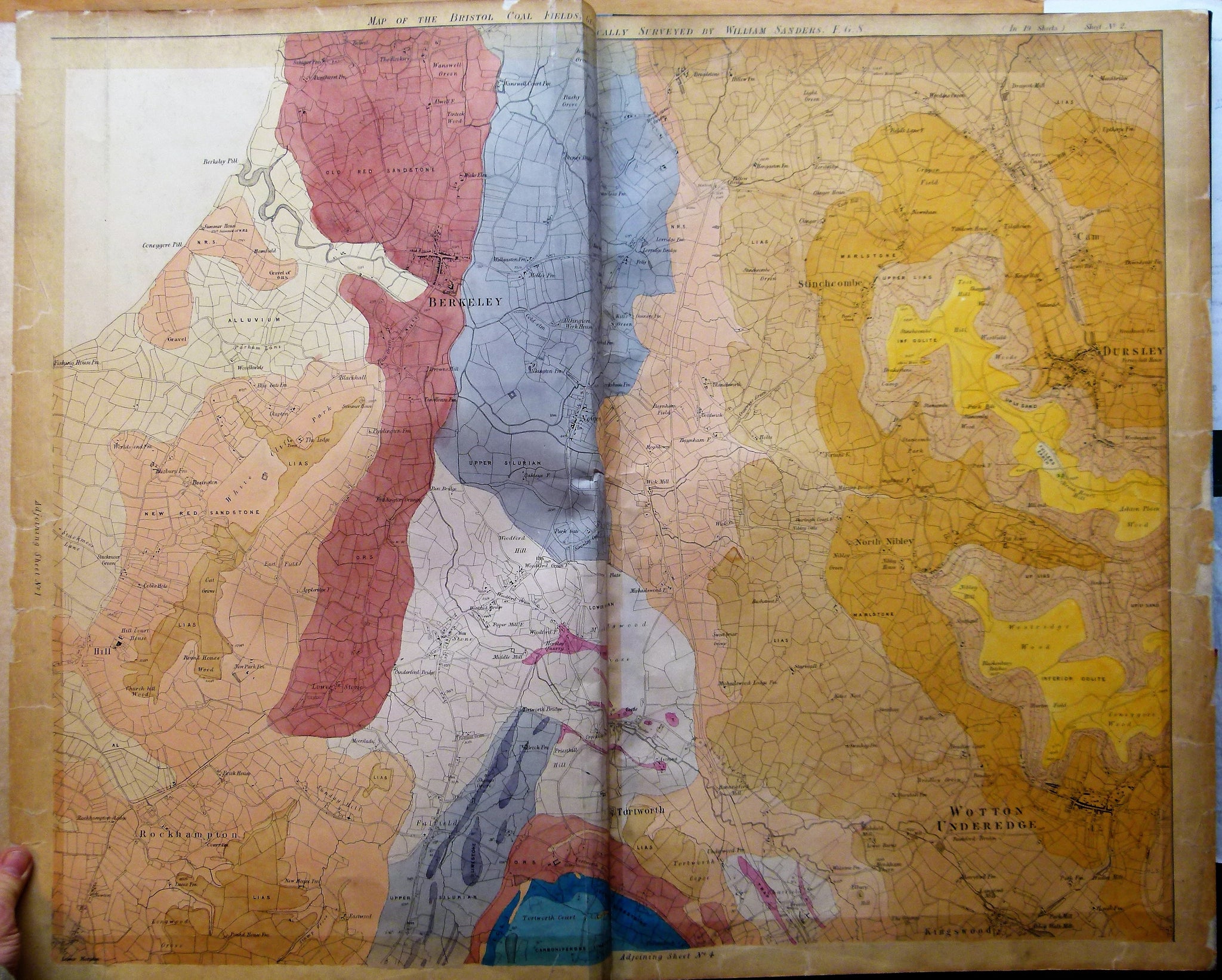
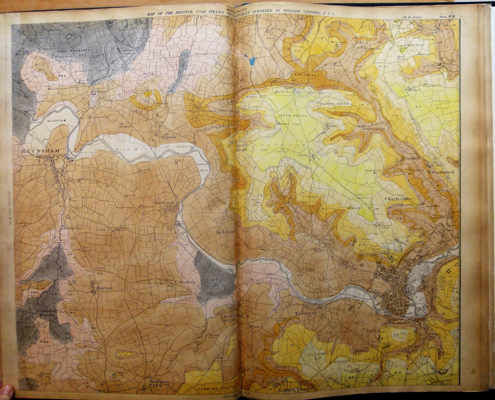
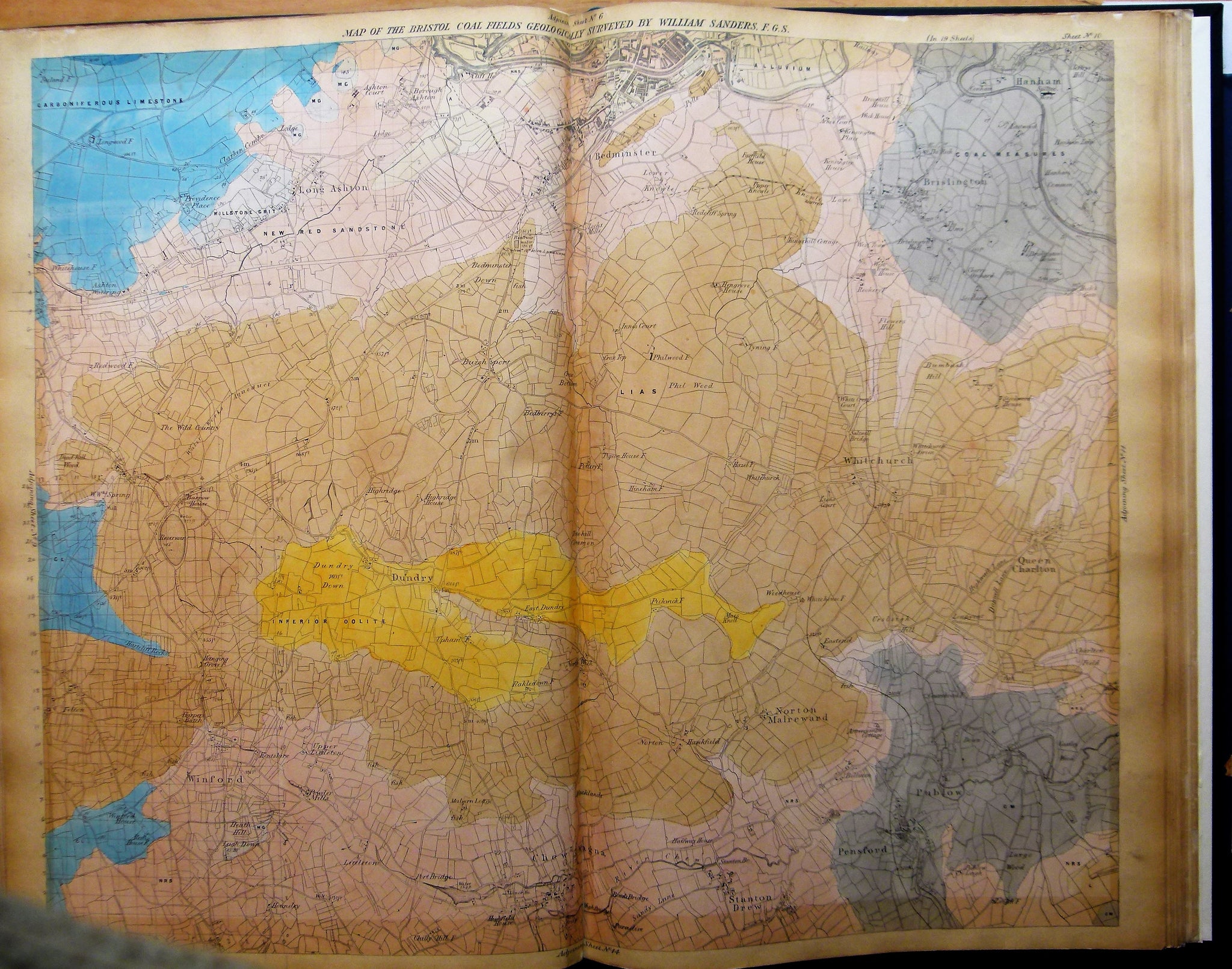
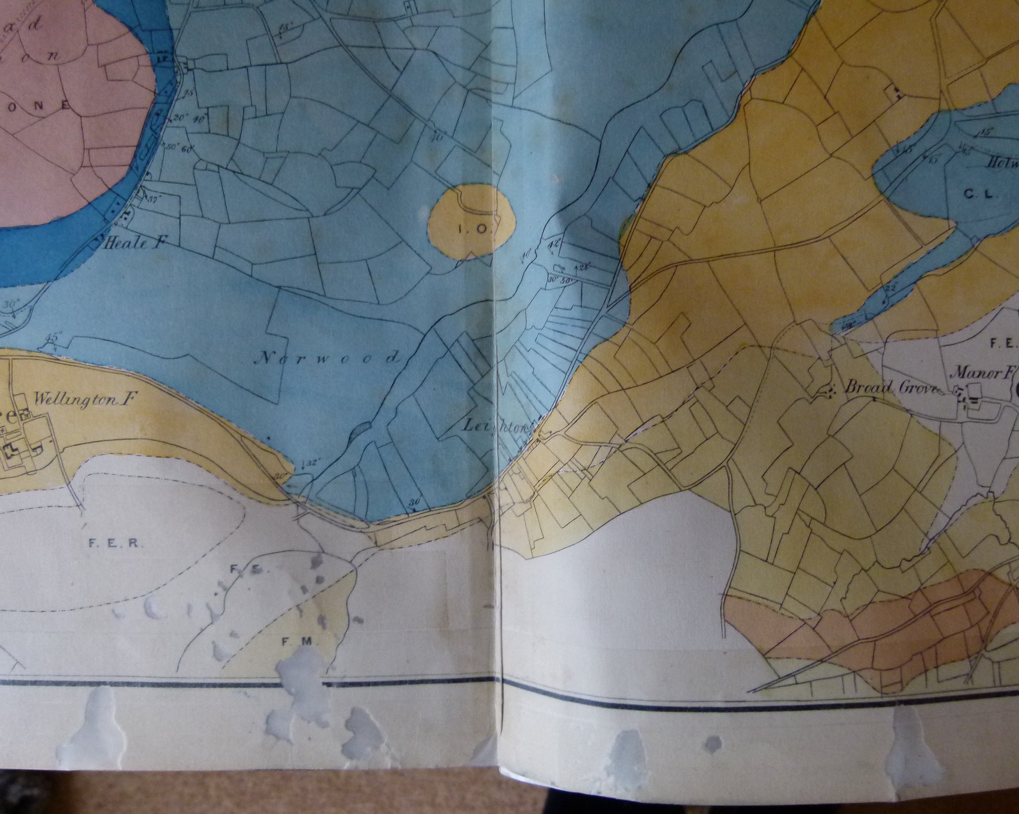
Sanders, William (1864). Map of the Bristol Coal Field and Country Adjacent in 19 Sheets, Geologically Surveyed. Hardback atlas, rebound with modern blue cloth covered boards, retaining original leather label. Leather binding. 65.5 x 45cm. 19 double page (64.5 x 81cm) maps each on stub to the binding, enabling the map to lie more or less flat when open. Each map at a scale of 1:15,840 (4 in = 1 mile) and restored with clear archival tape reinforcing page edges and centre folds. Limited insect damage on map 19 treated. Index map a modern copy. In good to very good condition.
Sanders assisted John Phillips and Henry De la Beche with the geological mapping of SW England in 1839-40. He fell out with De la Beche over an expenses claim and vowed to complete the geological mapping of his home district before De la Beche’s Geological Survey. He compiled the base map at his own expense and carried out all the field work, completing two years before the Geological Survey. Rare.