
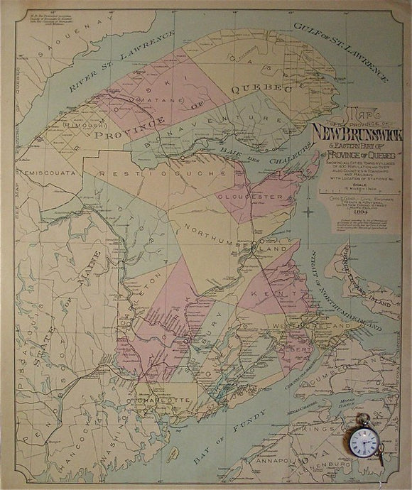
Map of the Province of New Brunswick and Eastern part (Gaspe Peninsula) of the Province of Quebec showing cities, towns and villages of population 400 or more, also Counties & Townships and Railways with Location of Stations, etc, …
Map of the Province of New Brunswick and Eastern part (Gaspe Peninsula) of the Province of Quebec showing cities, towns and villages of population 400 or more, also Counties & Townships and Railways with Location of Stations, etc, 1894. Scale 12=15miles (1:950,400). Not a geological map. Colour print, 63.5x53cm, flat, with minor marginal tears and a short grub trail not affect map or frameable area. Chas E Goad, civil engineer provided fire insurance maps all over Canada and the British Isles; this was the front map for a fire insurance atlas of the centres in the area listed in the title. In good condition.