
Geologic Map of the Taitzuho System (4 sheets)
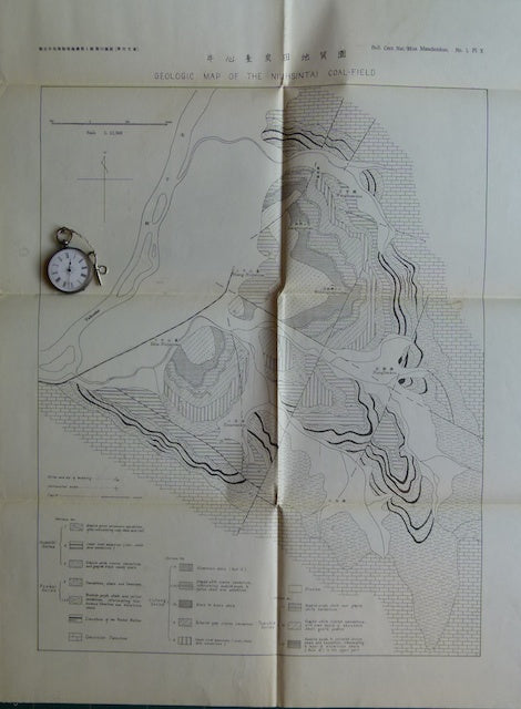
Geologic Map of the Taitzuho System (4 sheets), no date 1930s. Four b/w folded printed maps in English at 1:15,000 scale: VII Geologic Map of Fuchuo Coal-field (51.5x40.5cm); VIII Geologic Map of Yentai Coal-field (55.5x36cm); IX Geologic Map of Penhsisu Coal-field (73x66cm); and X Geologic Map of Niuhsintai Coal-field (61x46cm). in envelope 19x25.5cm. Manchoukou was the Japanese name for Manchuria which they controlled from 1931 to 1945.