
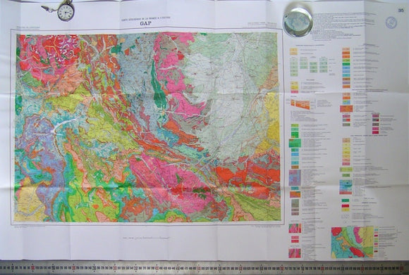
Gap, sheet 35 of Carte Geologique de France, 1980
Gap, sheet 35 of Carte Geologique de France, 1980. Scale 1:250.000. Folded, 66x96cm (26"x37.5") with 46pp of explanatory notes in French. (Gap is in the French Alps north of the Riviera). In fine, as new condition in plastic wallet. In fine, as new condition in plastic wallet. This is the current edition at Euros35 from BGRM.