
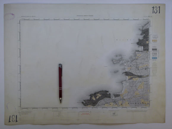


Ireland sheet 131, Mullagh, 1” scale. 1882. Covers Atlantic coast: Donegal Point, Mal Bay – 80% sea. Hand-coloured
Ireland sheet 131, Mullagh, 1” scale. 1882. Covers Atlantic coast: Donegal Point, Mal Bay – 80% sea. Base map not dated. Hand-coloured engraving, flat, trimmed 42 x 56cm, faint plate mark. Bright colours, clean. Library stamps in upper and lower left corners and stencilled numbers in upper right and lower left corners. In very good condition.
See also: Index Map for Irish One Inch Survey.