


Semenchenko, H.I. 1963. Ukraine. Tectonic Map of Area between the Dneiper and Deneister Rivers. 1:1,000,000
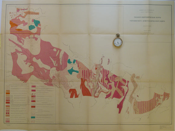
Semenchenko, H.I. [семенченко, н.]. 1963. Ukraine. Tectonic Map of Area between the Dneiper and Deneister Rivers. 1:1,000,000 scale folded colour printed map 66 x 91cm. folding out from attached 15 page explanatory booklet, 25 x 15cm. Map and booklet entirely in Cyrillic script. My transcription of title is based on map coverage. The zone extends from the border with Belarus in the NW (west of Kiev) and the Sea of Azov in the SE. In good to very good condition.