
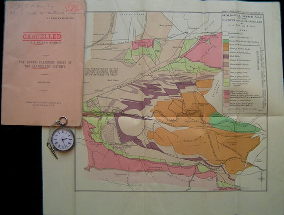
Geological Sketch-Map of the Country around Llangollen, 1922
Geological Sketch-Map of the Country around Llangollen, 1922, with accompanying paper as off-print included, The Lower Palaeozoic Rocks of the Llangollen District, 51pp + 2 other plates. Scale 1"=1mile, 14"x16.5" (12"x12.5"). In good condition, folded colour price