Free UK postage
Yorkshire, Sheet 95W½ 6", 1904 rev. Yorks, Masham, 27.5 x 40 - Colour wash on topographical map, No geol key but official cols., Good. Geological Survey of England & Wales.
Yorkshire. The Geology of the Concealed Coalfield of Yorkshire and Nottinghamshire by W Edwards (1951)…. Geological Survey of England & Wales.
Yorkshire: a Jouney through Time, Keyworth, British Geological Survey, 1996. Bell, Richard.
Zanchi, A. & Gaetani, M. 2011, Geological Map of the Central-Western Karakoram, Pakistan, in east and west parts, each 1:100,000 scale,
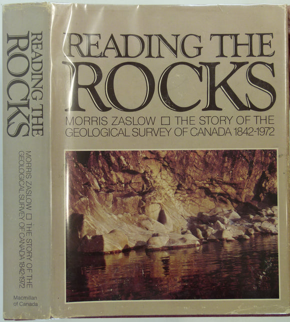
Zaslow, Morris. (1975). Reading the Rocks: the Story of the Geological Survey of Canada, 1842-1972. Toronto: Macmillan, 1st. Geological Survey of Canada.
[Geological Maps of] The Coal Fields of Westphalia and The Coal Fields of Bohemia, 1869, Plate 10, from Mines and Miners; or, Underground Life by L. Simonin
[Geological] Map of the Coal Fields of Durham and Northumberland and Cumberland, 1869, Plate 4, from Mines and Miners; or, Underground Life by L. Simonin
[Geological] Map of the Coal Fields of the United States, New Brunswick and Nova-Scotia, 1869, Plate 8, from Mines and Miners; or, Underground Life by L. Simonin
[Geological] Map of the Metalliferous Formations of Chile, 1869, Plate 11, from Mines and Miners; or, Underground Life by L. Simonin. Chapman and Hall.
‘The Golden Geyser – Robert Logan Jack and the Geology of Mount Morgan, Queensland’ extract from Archives…. Lambkin, Kevin.


![[Geological Maps of] The Coal Fields of Westphalia and The Coal Fields of Bohemia, 1869, Plate 10, from Mines and Miners; or, Underground Life by L. Simonin](http://geolmaps.com/cdn/shop/products/P1080650_{width}x.JPG?v=1551270987)
![[Geological Maps of] The Coal Fields of Westphalia and The Coal Fields of Bohemia, 1869, Plate 10, from Mines and Miners; or, Underground Life by L. Simonin](http://geolmaps.com/cdn/shop/products/P1080650_580x.JPG?v=1551270987)
![[Geological] Map of the Coal Fields of Durham and Northumberland and Cumberland, 1869, Plate 4, from Mines and Miners; or, Underground Life by L. Simonin](http://geolmaps.com/cdn/shop/products/P1080645_{width}x.JPG?v=1551270123)
![[Geological] Map of the Coal Fields of Durham and Northumberland and Cumberland, 1869, Plate 4, from Mines and Miners; or, Underground Life by L. Simonin](http://geolmaps.com/cdn/shop/products/P1080645_580x.JPG?v=1551270123)
![[Geological] Map of the Coal Fields of the United States, New Brunswick and Nova-Scotia, 1869, Plate 8, from Mines and Miners; or, Underground Life by L. Simonin](http://geolmaps.com/cdn/shop/products/P1080649_{width}x.JPG?v=1551270902)
![[Geological] Map of the Coal Fields of the United States, New Brunswick and Nova-Scotia, 1869, Plate 8, from Mines and Miners; or, Underground Life by L. Simonin](http://geolmaps.com/cdn/shop/products/P1080649_580x.JPG?v=1551270902)
![[Geological] Map of the Metalliferous Formations of Chile, 1869, Plate 11, from Mines and Miners; or, Underground Life by L. Simonin](http://geolmaps.com/cdn/shop/products/P1080651_{width}x.JPG?v=1551271089)
![[Geological] Map of the Metalliferous Formations of Chile, 1869, Plate 11, from Mines and Miners; or, Underground Life by L. Simonin](http://geolmaps.com/cdn/shop/products/P1080651_580x.JPG?v=1551271089)